Area Overview for CH46 7TQ
Photos of CH46 7TQ
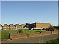
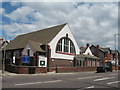
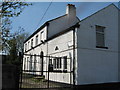
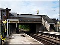
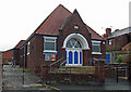

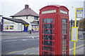
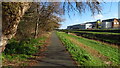
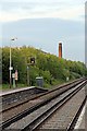
38 photos from this area
Area Information
Key information about the CH46 7TQ including its size, population, and administrative classification.
- Area Type
- Postcode
- Area Size
- 1.5 hectares
- Population
- 1524
- Population Density
- 98501 people/km²
House Prices in CH46 7TQ
21
Properties
£117,384
Average Sold Price
£32,000
Lowest Price
£215,000
Highest Price
Showing 21 properties
| Address | Type | Beds | Baths | Last Sale Price | Last Sale Date | |
|---|---|---|---|---|---|---|
| 47 Pasture Road, Moreton, CH46 7TQ | Terraced | 4 | 1 | £180,000 | Oct 2023 | |
| 45 Pasture Road, Moreton, CH46 7TQ | Terraced | 3 | 2 | £215,000 | Sep 2023 | |
| 67 Pasture Road, Moreton, CH46 7TQ | Terraced | 3 | 1 | £200,000 | Feb 2023 | |
| 59 Pasture Road, Moreton, CH46 7TQ | house | - | - | £115,000 | Aug 2019 | |
| 49 Pasture Road, Moreton, CH46 7TQ | Terraced | 3 | 1 | £130,110 | Jun 2018 | |
| 99 Pasture Road, Moreton, CH46 7TQ | Semi-detached | 3 | 1 | £102,000 | Mar 2018 | |
| 51 Pasture Road, Moreton, CH46 7TQ | house | - | - | £121,000 | Sep 2017 | |
| 61 Pasture Road, Moreton, CH46 7TQ | Terraced | - | - | £116,000 | Sep 2017 | |
| 57 Pasture Road, Moreton, CH46 7TQ | Terraced | - | - | £105,000 | Oct 2007 | |
| 95 Pasture Road, Moreton, CH46 7TQ | Terraced | - | - | £44,000 | Aug 2005 |
Page 1 of 3
Energy Efficiency in CH46 7TQ
Amenities
Schools
| Rank | School | Type | Entry gender | Ages |
|---|
Explore more schools in this area
Go to Schools tabDemographics
Household Size
One person
most common
Accommodation Type
Houses
most common
Tenure
52
majority
Ethnic Group
White
most common
Religion
N/A
most common
Household Composition
N/A
most common
Age
47
median
Adults (30-64 years)
most common
Household Deprivation
N/A
with no deprivation
NS-SEC
17
in Lower managerial occupations
Explore more demographic insights in this area
Go to Demographics tabPlanning
Planning Constraints
- Flood RiskPremium
- Ramsar Wetland SitesPremium
- Area of Outstanding Natural BeautyPremium
- Protected Nature ReservePremium
- Protected WoodlandPremium