Area Overview for CH46 5NN
Photos of CH46 5NN
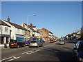
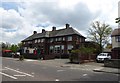
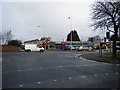
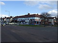
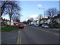
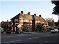

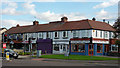

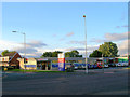

16 photos from this area
Area Information
Key information about the CH46 5NN including its size, population, and administrative classification.
- Area Type
- Postcode
- Area Size
- 1.7 hectares
- Population
- 1445
- Population Density
- 2220 people/km²
House Prices in CH46 5NN
31
Properties
£161,736
Average Sold Price
£38,000
Lowest Price
£350,000
Highest Price
Showing 31 properties
| Address | Type | Beds | Baths | Last Sale Price | Last Sale Date | |
|---|---|---|---|---|---|---|
| 14 Westbrook Road, Saughall Massie, CH46 5NN | Bungalow | 2 | 1 | £220,000 | Nov 2025 | |
| 9 Westbrook Road, Saughall Massie, CH46 5NN | Bungalow | 2 | 1 | £350,000 | Nov 2025 | |
| 17 Westbrook Road, Saughall Massie, CH46 5NN | Bungalow | - | - | £295,000 | Nov 2023 | |
| 2 Westbrook Road, Saughall Massie, CH46 5NN | Bungalow | - | - | £250,000 | Aug 2022 | |
| 11 Westbrook Road, Saughall Massie, CH46 5NN | Bungalow | - | - | £275,000 | Aug 2021 | |
| 8 Westbrook Road, Saughall Massie, CH46 5NN | Bungalow | - | - | £278,000 | Jun 2021 | |
| 6 Westbrook Road, Saughall Massie, CH46 5NN | Bungalow | - | - | £190,000 | Apr 2021 | |
| 38 Westbrook Road, Saughall Massie, CH46 5NN | Bungalow | - | - | £162,500 | Dec 2015 | |
| 32 Westbrook Road, Saughall Massie, CH46 5NN | Detached | - | - | £183,000 | Apr 2014 | |
| 42 Westbrook Road, Saughall Massie, CH46 5NN | Bungalow | 2 | - | £125,000 | Jun 2012 |
Page 1 of 4
Energy Efficiency in CH46 5NN
Amenities
Schools
| Rank | School | Type | Entry gender | Ages |
|---|
Explore more schools in this area
Go to Schools tabDemographics
Household Size
Two person
most common
Accommodation Type
Houses
most common
Tenure
89
majority
Ethnic Group
White
most common
Religion
N/A
most common
Household Composition
N/A
most common
Age
47
median
Adults (30-64 years)
most common
Household Deprivation
N/A
with no deprivation
NS-SEC
33
in Lower managerial occupations
Explore more demographic insights in this area
Go to Demographics tabPlanning
Planning Constraints
- Flood RiskPremium
- Ramsar Wetland SitesPremium
- Area of Outstanding Natural BeautyPremium
- Protected Nature ReservePremium
- Protected WoodlandPremium