Area Overview for CH46 0RZ
Photos of CH46 0RZ
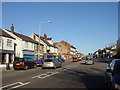
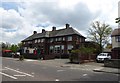
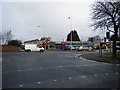
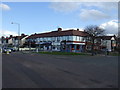
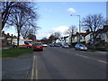
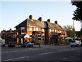
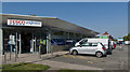
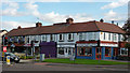
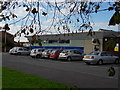
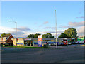
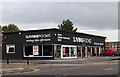
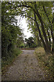
16 photos from this area
Area Information
Key information about the CH46 0RZ including its size, population, and administrative classification.
- Area Type
- Postcode
- Area Size
- 1.0 hectares
- Population
- 1577
- Population Density
- 4349 people/km²
House Prices in CH46 0RZ
28
Properties
£162,010
Average Sold Price
£64,000
Lowest Price
£350,000
Highest Price
Showing 28 properties
| Address | Type | Beds | Baths | Last Sale Price | Last Sale Date | |
|---|---|---|---|---|---|---|
| 30 Arrowe Avenue, Moreton, CH46 0RZ | house | - | - | £350,000 | Feb 2023 | |
| 6 Arrowe Avenue, Moreton, CH46 0RZ | house | - | - | £145,000 | Jan 2022 | |
| 2 Arrowe Avenue, Moreton, CH46 0RZ | Detached | - | - | £200,000 | Jun 2021 | |
| Conifers, 18 Arrowe Avenue, Moreton, CH46 0RZ | Bungalow | - | - | £235,000 | Dec 2020 | |
| 26 Arrowe Avenue, Moreton, CH46 0RZ | Bungalow | 3 | 1 | £233,000 | Aug 2020 | |
| 36 Arrowe Avenue, Moreton, CH46 0RZ | Semi-detached | 3 | 1 | £184,000 | Nov 2018 | |
| 24 Arrowe Avenue, Moreton, CH46 0RZ | Bungalow | - | - | £166,650 | Mar 2017 | |
| 50 Arrowe Avenue, Moreton, CH46 0RZ | house | - | - | £154,000 | Jan 2012 | |
| 38 Arrowe Avenue, Moreton, CH46 0RZ | house | - | - | £131,500 | Nov 2009 | |
| 14 Arrowe Avenue, Moreton, CH46 0RZ | Bungalow | - | - | £157,500 | Oct 2007 |
Page 1 of 3
Energy Efficiency in CH46 0RZ
Amenities
Schools
| Rank | School | Type | Entry gender | Ages |
|---|
Explore more schools in this area
Go to Schools tabDemographics
Household Size
Two person
most common
Accommodation Type
Houses
most common
Tenure
88
majority
Ethnic Group
White
most common
Religion
N/A
most common
Household Composition
N/A
most common
Age
47
median
Adults (30-64 years)
most common
Household Deprivation
N/A
with no deprivation
NS-SEC
27
in Lower managerial occupations
Explore more demographic insights in this area
Go to Demographics tabPlanning
Planning Constraints
- Flood RiskPremium
- Ramsar Wetland SitesPremium
- Area of Outstanding Natural BeautyPremium
- Protected Nature ReservePremium
- Protected WoodlandPremium