Area Overview for CH45 5BP
Photos of CH45 5BP


Area Information
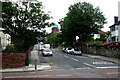
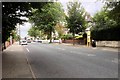
Ch45 5BP represents a specific postcode cluster located in the vibrant seaside resort of New Brighton on the Wirral Peninsula. This small residential area covers approximately 3318 square metres and is home to a population of 1653 people. You will find this postcode situated near the mouth of the River Mersey, modelling the layout of the famous Brighton resort. The area developed from a former smuggling and wrecking site into a leisure district by the early 20th century. Residents live close to landmarks like Perch Rock Battery, built in 1829, and the New Brighton Heritage and Information Centre. The setting offers a mix of Victorian villas on Wellington Road and North Drive alongside more modern developments. Daily life here involves the convenience of being near major transport hubs like New Brighton Railway Station and theLiverpool Belfast Ferry Terminal Bootle. You gain immediate access to the longest promenade in the UK, which stretches from Seacombe. The environment retains its historical character with surviving Art Deco features at the former lido site. Living in ch45 5BP means enjoying a location that balances coastal leisure with residential stability. You are surrounded by the unique blend of maritime heritage and modern suburban life. The area provides a distinct footprint within Wallasey without feeling isolated.
- Area Type
- Postcode
- Area Size
- 3318 m²
- Population
- 1653
- Population Density
- 9245 people/km²
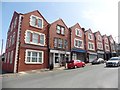
Buying a home in ch45 5BP involves navigating a market defined by owner-occupancy and traditional house stock. With 67 per cent of households owning their property, the area functions as a stable residential zone rather than a high-turnover rental market. You will encounter primarily houses, which contrasts with the flat-heavy markets common in city centres. This concentration of houses offers you more square footage and garden space for your investment. The lack of rental dominance suggests that sellers here are often looking for life restructuring rather than forcing a sale due to tenancy changes. The specific postcode covers a 3318 square metre cluster, ensuring that any search remains focused on a manageable selection of properties. Your competition will likely come from local families looking to stay in their village rather than speculative investors. The history of the area, including its development as a resort in 1830, supports a steady stream of sales for period properties. You benefit from lower noise pollution compared to bars and clubs found in other parts of the town. The market reflects the needs of adults aged 30 to 64, who plan to remain in their homes for the long term. When viewing homes in ch45 5BP, expect to see features of the original development, such as large frontages and maturity of gardens.
House Prices in CH45 5BP
Showing 12 properties
| Address | Type | Beds | Baths | Last Sale Price | Last Sale Date | |
|---|---|---|---|---|---|---|
| 1 Grafton Road, New Brighton, CH45 5BP | Semi-detached | 4 | 2 | £270,000 | Sep 2023 | |
| 3 Grafton Road, New Brighton, CH45 5BP | house | 4 | 1 | £265,000 | Sep 2022 | |
| 8 Grafton Road, New Brighton, CH45 5BP | house | - | - | £157,000 | Jul 2019 | |
| 15 Grafton Road, New Brighton, CH45 5BP | Detached | 4 | 1 | £194,000 | Jun 2015 | |
| 6 Grafton Road, New Brighton, CH45 5BP | Semi-detached | 3 | - | £120,000 | Sep 2013 | |
| 4 Grafton Road, New Brighton, CH45 5BP | house | 4 | - | £114,000 | Dec 2011 | |
| 11 Grafton Road, New Brighton, CH45 5BP | Semi-detached | - | - | £136,000 | May 2003 | |
| 7 Grafton Road, New Brighton, CH45 5BP | Semi-detached | - | - | £65,000 | May 2001 | |
| 9 Grafton Road, New Brighton, CH45 5BP | Semi-detached | 4 | 2 | £55,500 | Jan 1997 | |
| 2 Grafton Road, New Brighton, CH45 5BP | Semi-detached | - | - | - | - |
Energy Efficiency in CH45 5BP
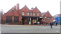
Daily life in ch45 5BP is supported by a network of amenities located within practical reach. You have five retail options nearby, ensuring you can stock up on groceries and essentials without venturing far. Specific venues include Iceland New, Morrisons New, and Asda Liscard for bulk shopping and weekly supplies. The area also boasts five railway stations, giving you flexible travel choices to and from the Wirral and beyond. You can reach New Brighton Railway Station, Wallasey Grove Road Railway Station, or Wallasey Village Railway Station based on your route. Leisure and commuting are simplified by five ferry terminals, including the Liverpool Belfast Ferry Terminal Bootle. You can also access the Seacombe Ferry Terminal and Birkenhead Ferry Terminal for daily crossings. These transport links enhance the lifestyle by reducing the perceived distance to city centres and other towns. Your daily routine involves walking to nearby shops or catching a quick train. The presence of these facilities creates a self-sufficient environment where you do not feel isolated. You can purchase groceries from Iceland New while enjoying the convenience of Morrisons New just across the boundary. The mix of rail and ferry transport offers redundancy in your daily travel plans.
Amenities
Schools
Families considering ch45 5BP will find New Brighton Primary School as their nearest educational option. This institution is a primary school and holds a 'Good' rating from Ofsted. The school serves the local cluster of residents and provides essential education within walking distance of many homes. As this is the only primary school listed for the area, you will need to assemble a secondary education plan for older children from other nearby institutions. The presence of a 'Good' rated school offers reassurance regarding the quality of basic education your children will receive. You do not have to travel extensively to ensure your offspring receive a solid foundation in reading and mathematics. The location of the school supports the family-focused nature of the demographic, where adults between 30 and 64 years form the majority. This school setting fits the profile of the surrounding houses and residences. The 'Good' rating indicates that staff and leadership meet national standards for pupil outcomes. You rely on this single named institution for primary needs, so checking transport links to New Brighton Primary School is a key step before purchasing. The school's performance directly impacts the attractiveness of homes near Wellington Road and North Drive.
| Rank | School | Type | Entry gender | Ages |
|---|
Explore more schools in this area
Go to Schools tabDemographics
The community within ch45 5BP displays an older age profile, with a median age of 47 years. Adults between the ages of 30 and 64 constitute the most common age range in the area. This demographic shift suggests a neighbourhood suited for families with older children or retirees seeking a quieter stop in the Wirral. Home ownership stands at a significant 67 per cent, indicating strong resident stability and a predominance of owner-occupied properties rather than short-term rentals. The accommodation type is almost exclusively houses, offering more space compared to urban flats. You will not find the diversity found in larger council estates, as the predominant ethnic group is White. This homogeneity contributes to a consistent community dynamic where long-term residents know their neighbours well. The high level of home ownership correlates with the presence of period properties like those on Montpellier Crescent. You do not need to worry about rapid tenant turnovers in this cluster. The population density reaches 498,211 people per square kilometre based on the total area size, reflecting a tightly knit residential cluster. Living here means dealing with an established community that values privacy and space.
Household Size
Accommodation Type
Tenure
Ethnic Group
Religion
Household Composition
Age
Household Deprivation
NS-SEC
Explore more demographic insights in this area
Go to Demographics tabPlanning
Planning Constraints
- Flood RiskPremium
- Ramsar Wetland SitesPremium
- Area of Outstanding Natural BeautyPremium
- Protected Nature ReservePremium
- Protected WoodlandPremium