Area Overview for CH45 2NA
Photos of CH45 2NA


Area Information
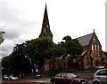
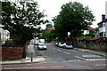
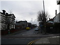
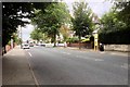
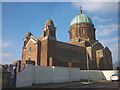
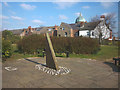
CH45 2NA is a small, densely populated residential cluster in the Wirral Peninsula, England, covering just 970 m². With 1,556 residents, it is a compact area where the high population density of 1.6 million people per square kilometre reflects its suburban character. This postcode falls within New Brighton, a historic seaside resort developed in the 19th century as a model for Brighton. The area combines coastal heritage with modern living, featuring Victorian villas, a long promenade, and remnants of its past as a smuggling hub. Daily life here is shaped by proximity to the River Mersey, with easy access to ferry terminals and rail links. Residents benefit from a mix of local amenities, including supermarkets, schools, and transport hubs, while the area’s compact size fosters a tight-knit community feel. Its history as a leisure destination persists through cultural landmarks like the New Brighton Heritage and Information Centre, offering insight into its evolution from a wrecking site to a residential district.
- Area Type
- Postcode
- Area Size
- 970 m²
- Population
- 1556
- Population Density
- 5874 people/km²
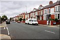
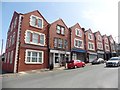
CH45 2NA is characterised by a high proportion of owner-occupied homes, with 69% of properties owned by residents rather than rented. The accommodation type is predominantly houses, which is notable given the area’s small size and high population density. This suggests a mix of larger, family-friendly properties alongside the compact residential layout. As a small postcode area, the housing stock is limited, which may make the market competitive for buyers. The presence of historic Victorian villas on roads like Wellington Road and Montpellier Crescent adds to the area’s distinct character, potentially appealing to those seeking period properties. However, the limited land area means development opportunities are constrained, and buyers should consider proximity to nearby suburbs for additional housing options.
House Prices in CH45 2NA
No properties found in this postcode.
Energy Efficiency in CH45 2NA
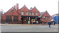
The lifestyle in CH45 2NA is shaped by its proximity to a range of amenities. Residents can access five rail stations, including New Brighton and Wallasey Village, which connect to major cities and suburbs. Retail options include Iceland New, Morrisons New, and Asda Liscard, providing everyday shopping convenience. Ferry terminals like Seacombe and Birkenhead offer quick travel across the Mersey, linking to Liverpool and beyond. The area’s coastal heritage is complemented by its leisure opportunities, such as the historic promenade and remnants of the Art Deco lido. These amenities create a blend of practicality and character, supporting both daily needs and recreational pursuits. The compact layout ensures that essential services are within walking or cycling distance, fostering a convenient, community-oriented lifestyle.
Amenities
Schools
Near CH45 2NA are two schools: Ss Peter and Paul Catholic Primary School, rated ‘good’ by Ofsted, and LIFE Wirral Sports School, an independent institution. The Catholic primary school serves the local community, offering a faith-based education with strong parental engagement. The independent school provides alternative educational options, often catering to families seeking specific curricula or facilities. This mix of school types offers families flexibility, whether they prioritise state education with strong local ties or independent schooling with specialised resources. Both institutions are within practical reach, reducing the need for long commutes. The ‘good’ Ofsted rating for the primary school indicates a reliable standard of education, which is a key consideration for families evaluating the area.
| Rank | School | Type | Entry gender | Ages |
|---|
Explore more schools in this area
Go to Schools tabDemographics
The population of CH45 2NA is predominantly adults aged 30–64, with a median age of 47. Home ownership is high at 69%, reflecting a stable community where most residents live in their own homes. The accommodation type is primarily houses, which is unusual for areas with such high density but aligns with New Brighton’s historical development. The predominant ethnic group is White, though the data does not specify further diversity metrics. The age profile suggests a mature demographic, which may influence local services and amenities. With no specific deprivation data provided, the area’s quality of life appears supported by its infrastructure, including schools, transport, and retail. The high home ownership rate indicates long-term residency, contributing to a sense of continuity and community cohesion.
Household Size
Accommodation Type
Tenure
Ethnic Group
Religion
Household Composition
Age
Household Deprivation
NS-SEC
Explore more demographic insights in this area
Go to Demographics tabPlanning
Planning Constraints
- Flood RiskPremium
- Ramsar Wetland SitesPremium
- Area of Outstanding Natural BeautyPremium
- Protected Nature ReservePremium
- Protected WoodlandPremium