Area Overview for CH44 6QY
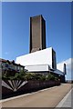
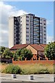
Photos of CH44 6QY


Area Information
Living in CH44 6QY means inhabiting a compact, densely populated residential cluster in the Wirral Peninsula. This area, covering just 3.9 hectares, is home to 1,367 people, translating to a population density of 35,274 per square kilometre — a stark reflection of its small size and high occupancy. Situated near the River Mersey, CH44 6QY retains historical ties to Seacombe, a district noted for its 19th-century industrial development and maritime connections. The area’s proximity to ferry terminals, rail stations, and retail hubs makes it a practical location for those prioritising connectivity. However, its small footprint means the community is tightly knit, with daily life shaped by limited space and shared amenities. The area’s name, derived from “Valley by the sea,” hints at its geographical character, though modern living here is defined by high-density housing and a reliance on nearby infrastructure for leisure and transport.
- Area Type
- Postcode
- Area Size
- 3.9 hectares
- Population
- 1367
- Population Density
- 2550 people/km²
CH44 6QY’s property market is characterised by a low home ownership rate — just 20% of residents own their homes — suggesting a strong rental market. The area’s accommodation type is predominantly houses, which is unusual for a small, high-density postcode. This combination implies limited housing stock, with properties likely concentrated among existing residents rather than new developments. Buyers considering CH44 6QY should note the area’s physical constraints: its 3.9-hectare size means little room for expansion, and the immediate surroundings may hold more viable options. The high population density also raises questions about space and privacy, factors that could deter buyers seeking larger properties. For those prioritising proximity to transport and amenities, the area’s compactness is an advantage, but its limited housing availability may necessitate looking beyond the postcode itself.
House Prices in CH44 6QY
Showing 6 properties
| Address | Type | Beds | Baths | Last Sale Price | Last Sale Date | |
|---|---|---|---|---|---|---|
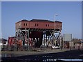
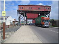
| Wallasey Cars Ltd, Seacombe Ferry Terminal, Victoria Place, Seacombe, CH44 6QY | passenger_terminal | - | - | - | - | |
| Seacombe Aquarium, Seacombe Ferry Terminal, Victoria Place, Seacombe, CH44 6QY | Leisure | - | - | - | - | |
| Mersey Ferries Head Office, Seacombe Ferry Terminal, Victoria Place, Seacombe, CH44 6QY | Office | - | - | - | - | |
| Staff Office, Seacombe Ferry Terminal, Victoria Place, Seacombe, CH44 6QY | Office | - | - | - | - | |
| The Grill, Seacombe Ferry Terminal, Victoria Place, Seacombe, CH44 6QY | Restaurant | - | - | - | - | |
| Play Planet, Seacombe Ferry Terminal, Victoria Place, Seacombe, CH44 6QY | Leisure | - | - | - | - |
Energy Efficiency in CH44 6QY
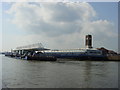
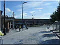
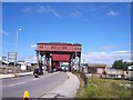
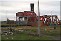
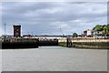
Daily life in CH44 6QY is shaped by its proximity to retail, transport, and historical sites. The area’s five ferry terminals, including the Seacombe Ferry Terminal, offer easy access to Liverpool and beyond, while five rail stations — such as Birkenhead Hamilton Square Railway Station — provide connections to the city’s transport network. Retail options are plentiful, with Heron Seacombe, Tesco Wallasey, and Sainsburys Liverpool within walking distance. For leisure, the area’s heritage includes Wallasey Town Hall, a Grade II listed building with historical significance, and Guinea Gap Baths, the oldest swimming pool in Wirral. The River Mersey’s proximity may also offer recreational opportunities, though the Ramsar wetland sites nearby could restrict certain activities. The compact nature of the area means amenities are tightly clustered, requiring minimal travel for essentials, though the small footprint may limit expansive green spaces or parks.
Amenities
Schools
| Rank | School | Type | Entry gender | Ages |
|---|
Explore more schools in this area
Go to Schools tabDemographics
The population of CH44 6QY skews towards adults aged 30–64, with a median age of 47. Only 20% of residents own their homes, suggesting a rental-dominated market, while the majority live in houses rather than flats. The predominant ethnic group is White, reflecting the area’s historical and demographic continuity. With 35,274 people per square kilometre, the density is exceptionally high, which may impact living conditions and communal spaces. This figure contextualises the area’s compact nature, where proximity to neighbours is inevitable. The age profile indicates a mature community, potentially with established families or professionals, though the lack of younger demographics may influence local services and amenities. The low home ownership rate could signal affordability challenges or a transient population, shaping the area’s social dynamics.
Household Size
Accommodation Type
Tenure
Ethnic Group
Religion
Household Composition
Age
Household Deprivation
NS-SEC
Explore more demographic insights in this area
Go to Demographics tabPlanning
Planning Constraints
- Flood RiskPremium
- Ramsar Wetland SitesPremium
- Area of Outstanding Natural BeautyPremium
- Protected Nature ReservePremium
- Protected WoodlandPremium