Area Overview for CH44 6LN
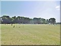
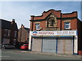
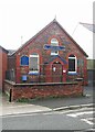
Photos of CH44 6LN

Area Information
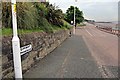
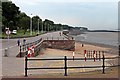
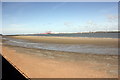
Living in CH44 6LN means residing in a small residential cluster on the Wirral Peninsula, positioned within the town of Wallasey. This specific postcode covers an area of just 860 square metres, housing a population of 1,465 people. The location derives its historical significance from its name, which translates to "Valley by the sea," and sits adjacent to the River Mersey. Historically, this ward was part of the County Borough of Wallasey before local government reorganisation in 1974. Today, the area functions as a distinct community where 146 residents per thousand square metres live in close proximity. The character of CH44 6LN is defined by its deep history, tracing back to a mention in the Domesday Book of 1086 as Seccum. By the 1850s, it evolved from a small country village into an industrial hub along the Wallasey Pool and docks following significant sea defence work in 1845. While passenger services on the original Wirral Railway line ended decades ago, the area retains a strong connection to its maritime past through its ferry links. Understanding this background provides context for the tightly knit nature of the neighbourhood. Whether you are exploring homes in CH44 6LN or visiting the nearby inland waterways, the history is palpable in the local landscape. It is a place where modern convenience meets a legacy of engineering and industry, offering a specific type of coastal living experience.
- Area Type
- Postcode
- Area Size
- 860 m²
- Population
- 1465
- Population Density
- 9872 people/km²
The property market in CH44 6LN is defined by a specific housing stock and a split between ownership and renting. Houses constitute the primary accommodation type for this residential cluster, offering a traditional living format for residents who prioritise detached or semi-detached dwellings. Currently, 40% of the population owns their homes, suggesting that the market includes both private owners and a significant rental sector. This balance indicates that the area is not exclusively an owner-occupied enclave nor a pure rental hub. For buyers looking at homes in CH44 6LN, the focus is on the character of this established housing rather than new developments. The mix means you can find properties suitable for various household types, from those seeking ownership stability to renters transitioning into this specific postcode. The area's small physical footprint of 860 square metres limits the variety of large estates, so individual property choices depend on the existing stock. Understanding the 40% ownership rate helps gauge the stability and turnover of the local market. It is a straightforward market where the emphasis is on the practicality and established nature of the houses available in this small cluster.
House Prices in CH44 6LN
Showing 4 properties
| Address | Type | Beds | Baths | Last Sale Price | Last Sale Date | |
|---|---|---|---|---|---|---|
| Flat 2 Key Chambers, 2-4 Liscard Road, Seacombe, CH44 6LN | Flat | - | - | - | - | |
| Flat 1 Key Chambers, 2-4 Liscard Road, Seacombe, CH44 6LN | Flat | - | - | - | - | |
| Flat 3 Key Chambers, 2-4 Liscard Road, Seacombe, CH44 6LN | Flat | - | - | - | - | |
| Flat 4 Key Chambers, 2-4 Liscard Road, Seacombe, CH44 6LN | Flat | - | - | - | - |
Energy Efficiency in CH44 6LN
Daily life in CH44 6LN offers convenient access to essential services and leisure facilities, primarily located in the nearby town of Wallasey. Residents enjoy five retail options within the vicinity, including the notable Heron Seacombe and two branches of Tesco Wallasey. These shops cover standard grocery needs and daily shopping requirements. For recreation, the area provides access to five ferry services, allowing easy travel to Seacombe Ferry Terminal or destinations across the river. Rail links are also available, with Birkenhead Park Railway Station, Birkenhead Hamilton Square Railway Station, and Conway Park Railway Station nearby for regional travel. Historical landmarks add depth to the lifestyle, such as Wallasey Town Hall, a Grade II listed building that served as a military hospital during World War I. Local leisure is highlighted by Guinea Gap Baths, the oldest swimming pool in the Wirral, which originally utilised seawater due to its proximity to the River Mersey. Founded in the 1890s, this facility has long been a focal point for community activity. Living in CH44 6LN means you are steps away from these historic and practical amenities. The blend of modern retail and historical leisure options creates a functional environment where your daily needs and cultural interests are met without excessive travel.
Amenities
Schools
| Rank | School | Type | Entry gender | Ages |
|---|
Explore more schools in this area
Go to Schools tabDemographics
The community in CH44 6LN reflects a mature population with a median age of 47 years. The most common age group comprises adults between 30 and 64 years old, indicating a resident base often centred on family stability or later-career professionals rather than young students or retirees. Approximately 40% of households in CH44 6LN own their homes, while the remaining majority rent their accommodation. This ownership rate suggests a diverse market where ownership is common but not universal. Houses are the predominant form of accommodation across the area, which aligns with the typical housing stock found in established Wirral wards. The population is predominantly White, forming the largest single ethnic group within the neighbourhood. This demographic profile paints a picture of a settled community with a specific cultural make-up. Given the area's size and the relatively older median age, daily life likely involves strong local traditions and established social networks. Residents aged 30 to 64 will find a peer group that matches their life stage, potentially making this an attractively stable environment for families seeking a traditional neighgbourhood feel rather than a transient student population.
Household Size
Accommodation Type
Tenure
Ethnic Group
Religion
Household Composition
Age
Household Deprivation
NS-SEC
Explore more demographic insights in this area
Go to Demographics tabPlanning
Planning Constraints
- Flood RiskPremium
- Ramsar Wetland SitesPremium
- Area of Outstanding Natural BeautyPremium
- Protected Nature ReservePremium
- Protected WoodlandPremium