Area Overview for CH44 0DF
Photos of CH44 0DF
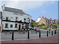


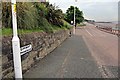
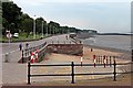


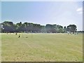

40 photos from this area
Area Information
Key information about the CH44 0DF including its size, population, and administrative classification.
- Area Type
- Postcode
- Area Size
- 3185 m²
- Population
- 1394
- Population Density
- 11559 people/km²
House Prices in CH44 0DF
22
Properties
£121,688
Average Sold Price
£20,000
Lowest Price
£180,000
Highest Price
Showing 22 properties
| Address | Type | Beds | Baths | Last Sale Price | Last Sale Date | |
|---|---|---|---|---|---|---|
| 69 Rice Lane, Egremont, CH44 0DF | Terraced | 4 | 1 | £180,000 | Aug 2023 | |
| 83 Rice Lane, Egremont, CH44 0DF | house | - | - | £170,000 | Sep 2022 | |
| 61 Rice Lane, Egremont, CH44 0DF | house | - | - | £150,000 | Sep 2022 | |
| 67 Rice Lane, Egremont, CH44 0DF | Terraced | 4 | 1 | £135,000 | Oct 2018 | |
| 79 Rice Lane, Egremont, CH44 0DF | Terraced | 5 | - | £116,000 | Jun 2017 | |
| 55 Rice Lane, Egremont, CH44 0DF | Terraced | 4 | 1 | £77,500 | Jul 2016 | |
| 65 Rice Lane, Egremont, CH44 0DF | Terraced | 4 | 2 | £125,000 | Mar 2007 | |
| 59 Rice Lane, Egremont, CH44 0DF | house | - | - | £20,000 | Sep 1999 | |
| 53 Rice Lane, Egremont, CH44 0DF | Terraced | 4 | 2 | - | - | |
| 77 Rice Lane, Egremont, CH44 0DF | Terraced | - | - | - | - |
Page 1 of 3
Energy Efficiency in CH44 0DF
Amenities
Schools
| Rank | School | Type | Entry gender | Ages |
|---|
Explore more schools in this area
Go to Schools tabDemographics
Household Size
One person
most common
Accommodation Type
Houses
most common
Tenure
34
majority
Ethnic Group
White
most common
Religion
N/A
most common
Household Composition
N/A
most common
Age
47
median
Adults (30-64 years)
most common
Household Deprivation
N/A
with no deprivation
NS-SEC
18
in Lower managerial occupations
Explore more demographic insights in this area
Go to Demographics tabPlanning
Planning Constraints
- Flood RiskPremium
- Ramsar Wetland SitesPremium
- Area of Outstanding Natural BeautyPremium
- Protected Nature ReservePremium
- Protected WoodlandPremium