Area Overview for CH43 7RQ
Photos of CH43 7RQ
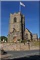
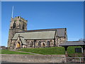
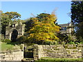
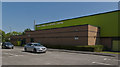
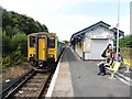
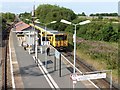
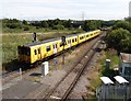
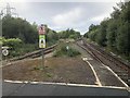
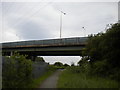
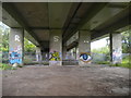
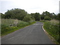
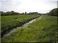
45 photos from this area
Area Information
Key information about the CH43 7RQ including its size, population, and administrative classification.
- Area Type
- Postcode
- Area Size
- 6822 m²
- Population
- 1374
- Population Density
- 2773 people/km²
House Prices in CH43 7RQ
11
Properties
£276,354
Average Sold Price
£38,000
Lowest Price
£600,000
Highest Price
Showing 11 properties
| Address | Type | Beds | Baths | Last Sale Price | Last Sale Date | |
|---|---|---|---|---|---|---|
| 24 School Lane, Bidston, CH43 7RQ | Semi-detached | 6 | 5 | £600,000 | Aug 2024 | |
| 36 School Lane, Bidston, CH43 7RQ | house | - | - | £452,000 | Apr 2023 | |
| 26 School Lane, Bidston, CH43 7RQ | Semi-detached | 7 | 3 | £385,000 | Feb 2021 | |
| 42 School Lane, Bidston, CH43 7RQ | Semi-detached | 7 | 2 | £370,000 | Sep 2020 | |
| 40 School Lane, Bidston, CH43 7RQ | Detached | 7 | 3 | £250,000 | Dec 2019 | |
| 38 School Lane, Bidston, CH43 7RQ | house | - | - | £300,000 | Feb 2018 | |
| 34 School Lane, Bidston, CH43 7RQ | Semi-detached | 4 | 2 | £210,000 | Dec 2013 | |
| 44 School Lane, Bidston, CH43 7RQ | house | - | - | £249,950 | Dec 2010 | |
| 32 School Lane, Bidston, CH43 7RQ | house | - | - | £124,999 | Oct 2006 | |
| 30 School Lane, Bidston, CH43 7RQ | house | - | - | £59,950 | Apr 1998 |
Page 1 of 2
Energy Efficiency in CH43 7RQ
Amenities
Schools
| Rank | School | Type | Entry gender | Ages |
|---|
Explore more schools in this area
Go to Schools tabDemographics
Household Size
Family (3-5 people)
most common
Accommodation Type
Houses
most common
Tenure
51
majority
Ethnic Group
White
most common
Religion
N/A
most common
Household Composition
N/A
most common
Age
47
median
Adults (30-64 years)
most common
Household Deprivation
N/A
with no deprivation
NS-SEC
27
in Lower managerial occupations
Explore more demographic insights in this area
Go to Demographics tabPlanning
Planning Constraints
- Flood RiskPremium
- Ramsar Wetland SitesPremium
- Area of Outstanding Natural BeautyPremium
- Protected Nature ReservePremium
- Protected WoodlandPremium