Area Overview for CH43 3DL
Photos of CH43 3DL
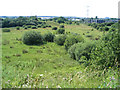
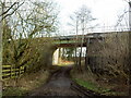
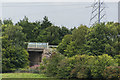
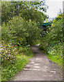
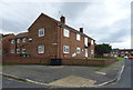
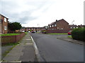

10 photos from this area
Area Information
Key information about the CH43 3DL including its size, population, and administrative classification.
- Area Type
- Postcode
- Area Size
- 7780 m²
- Population
- Not available
- Population Density
- Not available
House Prices in CH43 3DL
26
Properties
£129,882
Average Sold Price
£55,950
Lowest Price
£210,000
Highest Price
Showing 26 properties
| Address | Type | Beds | Baths | Last Sale Price | Last Sale Date | |
|---|---|---|---|---|---|---|
| 12 Byron Close, Prenton, CH43 3DL | Semi-detached | 4 | - | £210,000 | Nov 2024 | |
| 9 Byron Close, Prenton, CH43 3DL | Semi-detached | 3 | 2 | £182,500 | Sep 2023 | |
| 4 Byron Close, Prenton, CH43 3DL | Semi-detached | 3 | 1 | £182,500 | Sep 2023 | |
| 3 Byron Close, Prenton, CH43 3DL | Semi-detached | 3 | 1 | £165,000 | Apr 2022 | |
| 22 Byron Close, Prenton, CH43 3DL | Terraced | 2 | 1 | £151,000 | Nov 2021 | |
| 20 Byron Close, Prenton, CH43 3DL | house | - | - | £123,000 | Oct 2021 | |
| 19 Byron Close, Prenton, CH43 3DL | house | - | - | £135,000 | Sep 2019 | |
| 2 Byron Close, Prenton, CH43 3DL | Semi-detached | 3 | 1 | £138,000 | Mar 2017 | |
| 7 Byron Close, Prenton, CH43 3DL | house | - | - | £135,000 | Aug 2015 | |
| 27 Byron Close, Prenton, CH43 3DL | Terraced | 3 | - | £101,000 | May 2014 |
Page 1 of 3
Energy Efficiency in CH43 3DL
Amenities
Schools
| Rank | School | Type | Entry gender | Ages |
|---|
Explore more schools in this area
Go to Schools tabDemographics
Household Size
One person
most common
Accommodation Type
Houses
most common
Tenure
58
majority
Ethnic Group
White
most common
Religion
N/A
most common
Household Composition
N/A
most common
Age
47
median
Adults (30-64 years)
most common
Household Deprivation
N/A
with no deprivation
NS-SEC
26
in Lower managerial occupations
Explore more demographic insights in this area
Go to Demographics tabPlanning
Planning Constraints
- Flood RiskPremium
- Ramsar Wetland SitesPremium
- Area of Outstanding Natural BeautyPremium
- Protected Nature ReservePremium
- Protected WoodlandPremium