Area Overview for CH42 8PJ
Photos of CH42 8PJ
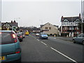
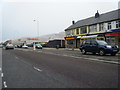
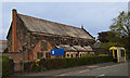
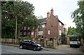
23 photos from this area
Area Information
Key information about the CH42 8PJ including its size, population, and administrative classification.
- Area Type
- Postcode
- Area Size
- 4461 m²
- Population
- 1485
- Population Density
- 4368 people/km²
House Prices in CH42 8PJ
9
Properties
£290,421
Average Sold Price
£205,000
Lowest Price
£359,950
Highest Price
Showing 9 properties
| Address | Type | Beds | Baths | Last Sale Price | Last Sale Date | |
|---|---|---|---|---|---|---|
| 9 Waterpark Road, Prenton, CH42 8PJ | house | - | - | £345,000 | Sep 2023 | |
| 11 Waterpark Road, Prenton, CH42 8PJ | house | - | - | £350,000 | Feb 2022 | |
| 23 Waterpark Road, Prenton, CH42 8PJ | house | - | - | £359,950 | Jul 2017 | |
| 15 Waterpark Road, Prenton, CH42 8PJ | Semi-detached | - | - | £288,000 | Jul 2010 | |
| 17 Waterpark Road, Prenton, CH42 8PJ | house | - | - | £205,000 | Sep 2009 | |
| 19 Waterpark Road, Prenton, CH42 8PJ | Semi-detached | 7 | 2 | £275,000 | Feb 2008 | |
| 21 Waterpark Road, Prenton, CH42 8PJ | house | - | - | £210,000 | Aug 2002 | |
| 25 Waterpark Road, Prenton, CH42 8PJ | Semi-detached | 7 | 2 | - | - | |
| 19A Waterpark Road, Prenton, CH42 8PJ | Flat | - | - | - | - |
Energy Efficiency in CH42 8PJ
Amenities
Schools
| Rank | School | Type | Entry gender | Ages |
|---|
Explore more schools in this area
Go to Schools tabDemographics
Household Size
Family (3-5 people)
most common
Accommodation Type
Houses
most common
Tenure
85
majority
Ethnic Group
White
most common
Religion
N/A
most common
Household Composition
N/A
most common
Age
47
median
Adults (30-64 years)
most common
Household Deprivation
N/A
with no deprivation
NS-SEC
43
in Lower managerial occupations
Explore more demographic insights in this area
Go to Demographics tabPlanning
Planning Constraints
- Flood RiskPremium
- Ramsar Wetland SitesPremium
- Area of Outstanding Natural BeautyPremium
- Protected Nature ReservePremium
- Protected WoodlandPremium