Area Overview for CH42 6WA
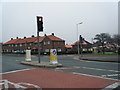
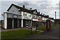
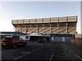
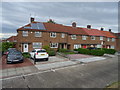
Photos of CH42 6WA


Area Information
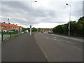
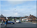
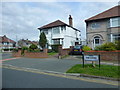
Living in CH42 6WA means being part of a tightly knit residential cluster in Prenton, a suburb of Birkenhead. With a population of 1,701, the area feels small-scale yet connected to the broader Wirral Peninsula. Prenton’s history as a rural hamlet with roots in the Domesday Book adds a layer of heritage to its modern character. The M53 motorway forms its western boundary, offering easy access to nearby towns, while its proximity to Tranmere, Rock Ferry, and Oxton ensures a range of local amenities. Daily life here balances quiet residential living with practical connectivity. The area’s low crime risk and absence of environmental constraints like protected woodlands or wetlands make it appealing for families and professionals. With a median age of 47 and a strong home ownership rate, the community leans towards mature, settled residents. Whether you’re drawn to the convenience of nearby rail and ferry links or the historical markers like the Prenton War Memorial, CH42 6WA offers a blend of stability and accessibility.
- Area Type
- Postcode
- Area Size
- Not available
- Population
- 1701
- Population Density
- 6233 people/km²
The property market in CH42 6WA is defined by high home ownership (76%) and a predominance of houses. This suggests a community where long-term residency is the norm, with fewer rental properties or apartments. The focus on houses rather than flats indicates a demand for space and privacy, appealing to families or professionals seeking stability. Given the area’s small size, the housing stock is likely limited to a few hundred properties, creating a tight local market. Buyers should consider the proximity to amenities like the M53 motorway and nearby rail and ferry links, which enhance connectivity. However, the lack of specific data on property prices or types means buyers must rely on local agents for detailed insights. The absence of planning constraints or environmental restrictions also makes it a pragmatic choice for those prioritising practical living over niche developments.
House Prices in CH42 6WA
No properties found in this postcode.
Energy Efficiency in CH42 6WA
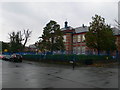
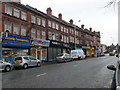
Life in CH42 6WA is enriched by a mix of retail, transport, and community amenities. Within practical reach are supermarkets like Morrisons Daily, Iceland Prenton, and Tesco Tranmere, ensuring everyday shopping needs are met. The area’s rail network includes Rock Ferry, Green Lane, and Birkenhead Central stations, while ferry terminals at Woodside Birkenhead and Liverpool Pier Head offer easy access to both sides of the Mersey. These transport links support a lifestyle that combines local convenience with broader connectivity. The presence of historical landmarks like the Prenton War Memorial and the Halfway House pub adds character to daily life, blending heritage with modern amenities. Whether for commuting, shopping, or leisure, residents have access to a range of facilities that support both practicality and a sense of place.
Amenities
Schools
| Rank | School | Type | Entry gender | Ages |
|---|
Explore more schools in this area
Go to Schools tabDemographics
The community in CH42 6WA is predominantly composed of adults aged 30–64, with a median age of 47. This suggests a mature population, likely with established careers and family ties. Home ownership is high at 76%, indicating a stable residential base with a focus on long-term living rather than transient rental tenancies. The area is characterised by houses rather than flats or apartments, reflecting a preference for private, spacious living. The predominant ethnic group is White, though specific diversity metrics are not provided. The age profile and ownership figures imply a community that values security and continuity. With no data on deprivation levels, the focus remains on the tangible aspects of life here: a low crime score of 76 (below average) and no environmental risks. This combination supports a quality of life that prioritises safety and comfort for residents.
Household Size
Accommodation Type
Tenure
Ethnic Group
Religion
Household Composition
Age
Household Deprivation
NS-SEC
Explore more demographic insights in this area
Go to Demographics tabPlanning
Planning Constraints
- Flood RiskPremium
- Ramsar Wetland SitesPremium
- Area of Outstanding Natural BeautyPremium
- Protected Nature ReservePremium
- Protected WoodlandPremium