Area Overview for CH42 6NZ
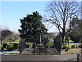
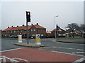
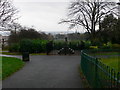
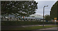
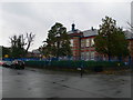
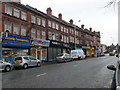
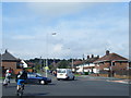
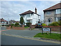
Photos of CH42 6NZ
Area Information
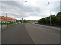
Living in CH42 6NZ means being part of a small, tightly knit residential cluster in Prenton, a suburb of Birkenhead on the Wirral Peninsula. With a population of 1,701, this area blends historical roots with modern convenience. Prenton’s origins as a rural hamlet with a water mill and woodland are still evident in its character, though today it is defined by its proximity to Tranmere, Rock Ferry, and the M53 motorway. The area’s compact size means residents enjoy a balance of suburban tranquillity and easy access to nearby towns. Daily life here is shaped by its strong sense of community, with amenities like supermarkets, railway stations, and ferry terminals within practical reach. The median age of 47 suggests a mature population, many of whom have lived in the area for years, contributing to its stable, family-oriented atmosphere. Whether commuting to Liverpool via rail or ferry, or simply enjoying the local shops, CH42 6NZ offers a straightforward, grounded lifestyle.
- Area Type
- Postcode
- Area Size
- Not available
- Population
- 1701
- Population Density
- 6233 people/km²
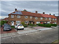
The property market in CH42 6NZ is dominated by owner-occupied homes, with 76% of residents living in properties they own. This high home ownership rate suggests a community of long-term residents rather than a transient rental market. The area’s accommodation is primarily houses, which implies a focus on larger, more spacious properties compared to flats or apartments. For buyers, this means a market that prioritises family homes and established living, with limited turnover. The small size of the area means that properties are likely to be closely located to local amenities and transport links. Given the lack of planning constraints from protected sites or environmental designations, developers have fewer restrictions, which could influence future housing availability. However, the area’s compact nature means buyers should consider the immediate surrounding zones for additional options.
House Prices in CH42 6NZ
No properties found in this postcode.
Energy Efficiency in CH42 6NZ
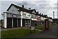
Residents of CH42 6NZ have access to a range of local amenities that support daily life. Within walking or short driving distance are retail outlets such as Tesco Tranmere, Iceland Prenton, and Morrisons Daily, ensuring convenience for grocery shopping. The area’s proximity to three railway stations — Rock Ferry, Green Lane, and Birkenhead Central — and three ferry terminals — Woodside Birkenhead, Birkenhead Ferry, and Liverpool Pier Head — provides multiple transport options for commuting or leisure travel. These connections make it easy to reach Liverpool’s cultural and commercial hubs. While the data does not mention parks or green spaces, the area’s historical roots in rural land suggest pockets of open space may exist. The combination of local shops, transport links, and suburban setting creates a practical, accessible lifestyle.
Amenities
Schools
| Rank | School | Type | Entry gender | Ages |
|---|
Explore more schools in this area
Go to Schools tabDemographics
The community in CH42 6NZ is predominantly composed of adults aged 30–64, with a median age of 47. This suggests a mature, established population, many of whom are likely to be homeowners. Home ownership here is high, with 76% of residents owning their homes, a figure that indicates a stable and long-term community. The area is characterised by houses rather than flats or apartments, reflecting a preference for larger, family-friendly properties. The predominant ethnic group is White, though the data does not specify further diversity metrics. The absence of detailed deprivation data means the area’s socio-economic profile remains focused on its demographic stability. With no significant age group skewing toward young families or retirees, the community appears balanced, with a focus on middle-aged residents maintaining a consistent lifestyle.
Household Size
Accommodation Type
Tenure
Ethnic Group
Religion
Household Composition
Age
Household Deprivation
NS-SEC
Explore more demographic insights in this area
Go to Demographics tabPlanning
Planning Constraints
- Flood RiskPremium
- Ramsar Wetland SitesPremium
- Area of Outstanding Natural BeautyPremium
- Protected Nature ReservePremium
- Protected WoodlandPremium