Area Overview for CH42 5PQ
Photos of CH42 5PQ
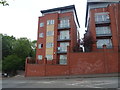
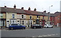
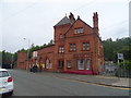
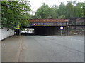
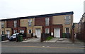
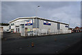
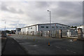
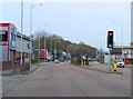
48 photos from this area
Area Information
Key information about the CH42 5PQ including its size, population, and administrative classification.
- Area Type
- Postcode
- Area Size
- 4497 m²
- Population
- 1438
- Population Density
- 10519 people/km²
House Prices in CH42 5PQ
37
Properties
£76,917
Average Sold Price
£20,000
Lowest Price
£205,000
Highest Price
Showing 37 properties
| Address | Type | Beds | Baths | Last Sale Price | Last Sale Date | |
|---|---|---|---|---|---|---|
| 59 Rosedale Road, Tranmere, CH42 5PQ | Terraced | 3 | 1 | £105,000 | Aug 2025 | |
| 50 Rosedale Road, Tranmere, CH42 5PQ | Terraced | 3 | 1 | £117,500 | Aug 2024 | |
| 51 Rosedale Road, Tranmere, CH42 5PQ | Terraced | 3 | - | £128,000 | Feb 2024 | |
| 70 Rosedale Road, Tranmere, CH42 5PQ | Terraced | 3 | 1 | £105,000 | Feb 2023 | |
| 57 Rosedale Road, Tranmere, CH42 5PQ | Terraced | 3 | 1 | £99,000 | Nov 2022 | |
| 58 Rosedale Road, Tranmere, CH42 5PQ | house | 3 | 1 | £88,000 | Oct 2022 | |
| 38 Rosedale Road, Tranmere, CH42 5PQ | Terraced | 3 | 1 | £100,000 | Dec 2021 | |
| 47 Rosedale Road, Tranmere, CH42 5PQ | Terraced | 3 | 1 | £101,000 | Sep 2021 | |
| 62 Rosedale Road, Tranmere, CH42 5PQ | house | - | - | £90,000 | May 2021 | |
| 52 Rosedale Road, Tranmere, CH42 5PQ | house | - | - | £205,000 | Mar 2021 |
Page 1 of 4
Energy Efficiency in CH42 5PQ
Amenities
Schools
| Rank | School | Type | Entry gender | Ages |
|---|
Explore more schools in this area
Go to Schools tabDemographics
Household Size
One person
most common
Accommodation Type
Houses
most common
Tenure
48
majority
Ethnic Group
White
most common
Religion
N/A
most common
Household Composition
N/A
most common
Age
47
median
Adults (30-64 years)
most common
Household Deprivation
N/A
with no deprivation
NS-SEC
21
in Lower managerial occupations
Explore more demographic insights in this area
Go to Demographics tabPlanning
Planning Constraints
- Flood RiskPremium
- Ramsar Wetland SitesPremium
- Area of Outstanding Natural BeautyPremium
- Protected Nature ReservePremium
- Protected WoodlandPremium