Area Overview for CH42 5PB
Photos of CH42 5PB
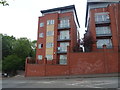
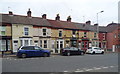
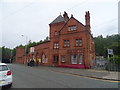
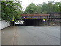
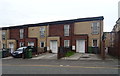
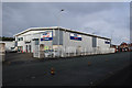
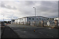
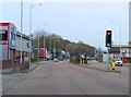
48 photos from this area
Area Information
Key information about the CH42 5PB including its size, population, and administrative classification.
- Area Type
- Postcode
- Area Size
- 2761 m²
- Population
- 1702
- Population Density
- 9097 people/km²
House Prices in CH42 5PB
23
Properties
£48,353
Average Sold Price
£11,000
Lowest Price
£100,000
Highest Price
Showing 23 properties
| Address | Type | Beds | Baths | Last Sale Price | Last Sale Date | |
|---|---|---|---|---|---|---|
| 45 Oriel Road, Tranmere, CH42 5PB | Terraced | 2 | 1 | £85,000 | Jan 2025 | |
| 9 Oriel Road, Tranmere, CH42 5PB | Terraced | 2 | 1 | £80,000 | May 2024 | |
| 13 Oriel Road, Tranmere, CH42 5PB | Terraced | 3 | 1 | £80,000 | Nov 2023 | |
| 5 Oriel Road, Tranmere, CH42 5PB | house | - | - | £100,000 | Oct 2022 | |
| 33 Oriel Road, Tranmere, CH42 5PB | Terraced | 2 | 1 | £75,000 | Jun 2022 | |
| 29 Oriel Road, Tranmere, CH42 5PB | Terraced | 2 | 1 | £100,000 | Jul 2021 | |
| 39 Oriel Road, Tranmere, CH42 5PB | Terraced | 2 | 1 | £51,000 | Jul 2019 | |
| 11 Oriel Road, Tranmere, CH42 5PB | Terraced | 2 | 1 | £45,000 | Oct 2014 | |
| 7 Oriel Road, Tranmere, CH42 5PB | Terraced | 2 | 1 | £38,500 | Dec 2003 | |
| 27 Oriel Road, Tranmere, CH42 5PB | house | 2 | 1 | £31,750 | Apr 2002 |
Page 1 of 3
Energy Efficiency in CH42 5PB
Amenities
Schools
| Rank | School | Type | Entry gender | Ages |
|---|
Explore more schools in this area
Go to Schools tabDemographics
Household Size
One person
most common
Accommodation Type
Houses
most common
Tenure
38
majority
Ethnic Group
White
most common
Religion
N/A
most common
Household Composition
N/A
most common
Age
47
median
Adults (30-64 years)
most common
Household Deprivation
N/A
with no deprivation
NS-SEC
15
in Lower managerial occupations
Explore more demographic insights in this area
Go to Demographics tabPlanning
Planning Constraints
- Flood RiskPremium
- Ramsar Wetland SitesPremium
- Area of Outstanding Natural BeautyPremium
- Protected Nature ReservePremium
- Protected WoodlandPremium