Area Overview for CH42 5LU
Photos of CH42 5LU
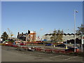
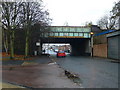
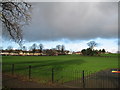
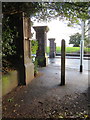
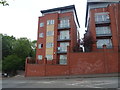
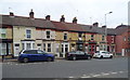
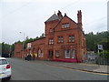
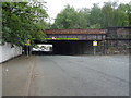
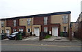
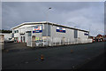
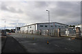
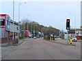
48 photos from this area
Area Information
Key information about the CH42 5LU including its size, population, and administrative classification.
- Area Type
- Postcode
- Area Size
- 5.6 hectares
- Population
- Not available
- Population Density
- Not available
House Prices in CH42 5LU
25
Properties
£112,900
Average Sold Price
£36,500
Lowest Price
£178,000
Highest Price
Showing 25 properties
| Address | Type | Beds | Baths | Last Sale Price | Last Sale Date | |
|---|---|---|---|---|---|---|
| 17 Agnes Road, Tranmere, CH42 5LU | Terraced | 3 | 1 | £125,000 | Jan 2019 | |
| 33 Agnes Road, Tranmere, CH42 5LU | Terraced | 3 | 1 | £122,500 | Dec 2018 | |
| 3 Agnes Road, Tranmere, CH42 5LU | Terraced | 3 | 1 | £122,000 | Jul 2017 | |
| Mersey Lodge, Agnes Road, Tranmere, CH42 5LU | Detached | 3 | - | £178,000 | Jul 2016 | |
| 27 Agnes Road, Tranmere, CH42 5LU | Terraced | - | - | £126,101 | Aug 2008 | |
| 5 Agnes Road, Tranmere, CH42 5LU | Terraced | 3 | 1 | £116,000 | Jul 2007 | |
| 39 Agnes Road, Tranmere, CH42 5LU | Terraced | - | - | £135,000 | May 2006 | |
| 29 Agnes Road, Tranmere, CH42 5LU | Terraced | - | - | £55,000 | Apr 2001 | |
| 31 Agnes Road, Tranmere, CH42 5LU | Terraced | - | - | £36,500 | Sep 1997 | |
| 41 Agnes Road, Tranmere, CH42 5LU | Flat | - | - | - | - |
Page 1 of 3
Energy Efficiency in CH42 5LU
Amenities
Schools
| Rank | School | Type | Entry gender | Ages |
|---|
Explore more schools in this area
Go to Schools tabDemographics
Household Size
One person
most common
Accommodation Type
Houses
most common
Tenure
32
majority
Ethnic Group
White
most common
Religion
N/A
most common
Household Composition
N/A
most common
Age
47
median
Adults (30-64 years)
most common
Household Deprivation
N/A
with no deprivation
NS-SEC
16
in Lower managerial occupations
Explore more demographic insights in this area
Go to Demographics tabPlanning
Planning Constraints
- Flood RiskPremium
- Ramsar Wetland SitesPremium
- Area of Outstanding Natural BeautyPremium
- Protected Nature ReservePremium
- Protected WoodlandPremium