Area Overview for CH41 7AJ
Photos of CH41 7AJ
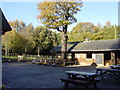


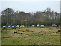
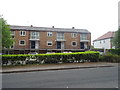
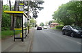

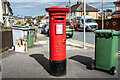
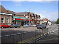
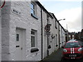
36 photos from this area
Area Information
Key information about the CH41 7AJ including its size, population, and administrative classification.
- Area Type
- Postcode
- Area Size
- 6166 m²
- Population
- 1554
- Population Density
- 5348 people/km²
House Prices in CH41 7AJ
18
Properties
£124,250
Average Sold Price
£32,000
Lowest Price
£250,000
Highest Price
Showing 18 properties
| Address | Type | Beds | Baths | Last Sale Price | Last Sale Date | |
|---|---|---|---|---|---|---|
| 337 Laird Street, Birkenhead, CH41 7AJ | Semi-detached | 1 | 1 | £165,000 | Nov 2024 | |
| The Old Police Station, Laird Street, Birkenhead, CH41 7AJ | Detached | 10 | 3 | £250,000 | Aug 2021 | |
| 347 Laird Street, Birkenhead, CH41 7AJ | Semi-detached | - | - | £50,000 | Mar 2004 | |
| 341 Laird Street, Birkenhead, CH41 7AJ | house | - | - | £32,000 | Feb 2002 | |
| 345 Laird Street, Birkenhead, CH41 7AJ | house | - | - | - | - | |
| 339 Laird Street, Birkenhead, CH41 7AJ | Semi-detached | - | - | - | - | |
| 343 Laird Street, Birkenhead, CH41 7AJ | house | - | - | - | - | |
| Inpost, Inpost Electronic Delivery Locker, Bp Service Station, Laird Street, Birkenhead, CH41 7AJ | Retail | - | - | - | - | |
| Bedsit 8, The Old Police Station, Laird Street, Birkenhead, CH41 7AJ | Unknown | - | - | - | - | |
| Bedsit 9, The Old Police Station, Laird Street, Birkenhead, CH41 7AJ | Unknown | - | - | - | - |
Page 1 of 2
Energy Efficiency in CH41 7AJ
Amenities
Schools
| Rank | School | Type | Entry gender | Ages |
|---|
Explore more schools in this area
Go to Schools tabDemographics
Household Size
One person
most common
Accommodation Type
Houses
most common
Tenure
23
majority
Ethnic Group
White
most common
Religion
N/A
most common
Household Composition
N/A
most common
Age
47
median
Adults (30-64 years)
most common
Household Deprivation
N/A
with no deprivation
NS-SEC
13
in Lower managerial occupations
Explore more demographic insights in this area
Go to Demographics tabPlanning
Planning Constraints
- Flood RiskPremium
- Ramsar Wetland SitesPremium
- Area of Outstanding Natural BeautyPremium
- Protected Nature ReservePremium
- Protected WoodlandPremium