Area Overview for CH41 4HU
Photos of CH41 4HU
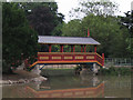
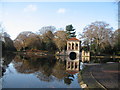
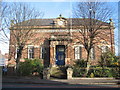
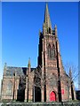
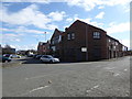
60 photos from this area
Area Information
Key information about the CH41 4HU including its size, population, and administrative classification.
- Area Type
- Postcode
- Area Size
- 2798 m²
- Population
- 1634
- Population Density
- 8988 people/km²
House Prices in CH41 4HU
31
Properties
£52,846
Average Sold Price
£14,750
Lowest Price
£110,000
Highest Price
Showing 31 properties
| Address | Type | Beds | Baths | Last Sale Price | Last Sale Date | |
|---|---|---|---|---|---|---|
| 37 Newling Street, Birkenhead, CH41 4HU | Terraced | 2 | 1 | £72,000 | Jul 2025 | |
| 49 Newling Street, Birkenhead, CH41 4HU | Terraced | 2 | 1 | £70,000 | May 2025 | |
| 33 Newling Street, Birkenhead, CH41 4HU | Terraced | 2 | 1 | £58,500 | May 2025 | |
| 23 Newling Street, Birkenhead, CH41 4HU | Terraced | 2 | 1 | £110,000 | May 2025 | |
| 15 Newling Street, Birkenhead, CH41 4HU | Terraced | 2 | 1 | £70,000 | Mar 2025 | |
| 25 Newling Street, Birkenhead, CH41 4HU | Detached | 2 | - | £68,000 | Oct 2024 | |
| 35 Newling Street, Birkenhead, CH41 4HU | house | - | - | £39,250 | Oct 2024 | |
| 41 Newling Street, Birkenhead, CH41 4HU | Terraced | 2 | 1 | £70,500 | Oct 2023 | |
| 51 Newling Street, Birkenhead, CH41 4HU | house | - | - | £88,000 | Aug 2022 | |
| 57 Newling Street, Birkenhead, CH41 4HU | Terraced | 2 | 1 | £72,500 | May 2022 |
Page 1 of 4
Energy Efficiency in CH41 4HU
Amenities
Schools
| Rank | School | Type | Entry gender | Ages |
|---|
Explore more schools in this area
Go to Schools tabDemographics
Household Size
One person
most common
Accommodation Type
Houses
most common
Tenure
53
majority
Ethnic Group
White
most common
Religion
N/A
most common
Household Composition
N/A
most common
Age
47
median
Adults (30-64 years)
most common
Household Deprivation
N/A
with no deprivation
NS-SEC
21
in Lower managerial occupations
Explore more demographic insights in this area
Go to Demographics tabPlanning
Planning Constraints
- Flood RiskPremium
- Ramsar Wetland SitesPremium
- Area of Outstanding Natural BeautyPremium
- Protected Nature ReservePremium
- Protected WoodlandPremium