Area Overview for CH41 4HG
Photos of CH41 4HG
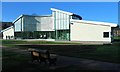
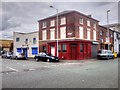
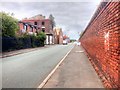
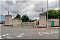
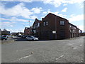
60 photos from this area
Area Information
Key information about the CH41 4HG including its size, population, and administrative classification.
- Area Type
- Postcode
- Area Size
- 3961 m²
- Population
- 1209
- Population Density
- 1656 people/km²
House Prices in CH41 4HG
12
Properties
£68,400
Average Sold Price
£44,000
Lowest Price
£91,000
Highest Price
Showing 12 properties
| Address | Type | Beds | Baths | Last Sale Price | Last Sale Date | |
|---|---|---|---|---|---|---|
| 90 Livingstone Street, Birkenhead, CH41 4HG | house | - | - | £75,000 | May 2025 | |
| 104 Livingstone Street, Birkenhead, CH41 4HG | Terraced | 3 | - | £91,000 | Jul 2024 | |
| 100 Livingstone Street, Birkenhead, CH41 4HG | Terraced | - | - | £64,000 | Jun 2021 | |
| 102 Livingstone Street, Birkenhead, CH41 4HG | Terraced | - | - | £44,000 | Nov 2014 | |
| 106 Livingstone Street, Birkenhead, CH41 4HG | Terraced | - | - | £68,000 | Feb 2006 | |
| 98 Livingstone Street, Birkenhead, CH41 4HG | Terraced | 2 | - | - | - | |
| 115 Livingstone Street, Birkenhead, CH41 4HG | house | - | - | - | - | |
| 96 Livingstone Street, Birkenhead, CH41 4HG | house | - | - | - | - | |
| 88 Livingstone Street, Birkenhead, CH41 4HG | house | - | - | - | - | |
| 92 Livingstone Street, Birkenhead, CH41 4HG | house | - | - | - | - |
Page 1 of 2
Energy Efficiency in CH41 4HG
Amenities
Schools
| Rank | School | Type | Entry gender | Ages |
|---|
Explore more schools in this area
Go to Schools tabDemographics
Household Size
One person
most common
Accommodation Type
Houses
most common
Tenure
16
majority
Ethnic Group
White
most common
Religion
N/A
most common
Household Composition
N/A
most common
Age
47
median
Adults (30-64 years)
most common
Household Deprivation
N/A
with no deprivation
NS-SEC
14
in Lower managerial occupations
Explore more demographic insights in this area
Go to Demographics tabPlanning
Planning Constraints
- Flood RiskPremium
- Ramsar Wetland SitesPremium
- Area of Outstanding Natural BeautyPremium
- Protected Nature ReservePremium
- Protected WoodlandPremium