Area Overview for CH41 2TG
Photos of CH41 2TG
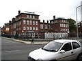
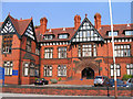
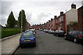
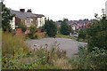
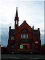
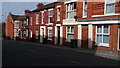

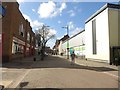
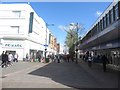
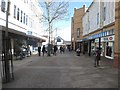


65 photos from this area
Area Information
Key information about the CH41 2TG including its size, population, and administrative classification.
- Area Type
- Postcode
- Area Size
- 9384 m²
- Population
- Not available
- Population Density
- Not available
House Prices in CH41 2TG
46
Properties
£116,517
Average Sold Price
£47,500
Lowest Price
£181,250
Highest Price
Showing 46 properties
| Address | Type | Beds | Baths | Last Sale Price | Last Sale Date | |
|---|---|---|---|---|---|---|
| 84 Whetstone Lane, Tranmere, CH41 2TG | house | 5 | - | £85,000 | Jan 2016 | |
| 90 Whetstone Lane, Tranmere, CH41 2TG | Terraced | 5 | - | £140,000 | Sep 2015 | |
| 108 Whetstone Lane, Tranmere, CH41 2TG | Terraced | 5 | 2 | £181,250 | Dec 2007 | |
| 82 Whetstone Lane, Tranmere, CH41 2TG | house | - | - | £130,000 | Jan 2005 | |
| 86 Whetstone Lane, Tranmere, CH41 2TG | house | - | - | £120,000 | Aug 2004 | |
| 80 Whetstone Lane, Tranmere, CH41 2TG | house | - | - | £145,950 | Aug 2004 | |
| 88 Whetstone Lane, Tranmere, CH41 2TG | Terraced | - | - | £114,000 | May 2004 | |
| 106 Whetstone Lane, Tranmere, CH41 2TG | Semi-detached | 5 | - | £47,500 | Dec 2001 | |
| 70 Whetstone Lane, Tranmere, CH41 2TG | Terraced | - | - | £84,950 | Nov 2001 | |
| 9, Whetstone Court, Whetstone Lane, Tranmere, CH41 2TG | Flat | - | - | - | - |
Page 1 of 5
Energy Efficiency in CH41 2TG
Amenities
Schools
| Rank | School | Type | Entry gender | Ages |
|---|
Explore more schools in this area
Go to Schools tabDemographics
Household Size
One person
most common
Accommodation Type
Houses
most common
Tenure
41
majority
Ethnic Group
White
most common
Religion
N/A
most common
Household Composition
N/A
most common
Age
47
median
Adults (30-64 years)
most common
Household Deprivation
N/A
with no deprivation
NS-SEC
17
in Lower managerial occupations
Explore more demographic insights in this area
Go to Demographics tabPlanning
Planning Constraints
- Flood RiskPremium
- Ramsar Wetland SitesPremium
- Area of Outstanding Natural BeautyPremium
- Protected Nature ReservePremium
- Protected WoodlandPremium