Area Overview for CH41 1NB
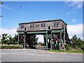
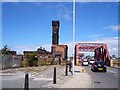
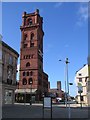
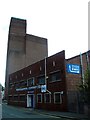
Photos of CH41 1NB


Area Information
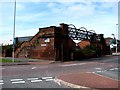
Living in CH41 1NB means being part of a compact residential cluster in the Wirral Peninsula, where history and modernity intersect. The area is part of the Birkenhead and Tranmere Ward, a historically significant district with roots in Old Norse and medieval times. With a population of 1,022, it is a tight-knit community centred around Tranmere, a suburb with a distinct urban residential character. The area’s proximity to Birkenhead’s transport networks and historical sites, such as St Catherine’s Church and Tranmere Old Hall, adds to its appeal. Daily life here balances quiet living with access to nearby amenities, from ferry terminals to retail hubs. The small size of the postcode means residents are close to each other, fostering a sense of familiarity. While the area lacks large-scale developments, its charm lies in its manageable scale and the ease of navigating local services. For those seeking a place with a manageable footprint and a blend of historical and contemporary features, CH41 1NB offers a focused living environment.
- Area Type
- Postcode
- Area Size
- Not available
- Population
- 1022
- Population Density
- 1235 people/km²
The property market in CH41 1NB is defined by a low home ownership rate of 22%, suggesting that the majority of properties are rented rather than owner-occupied. The accommodation type is primarily houses, which contrasts with the higher proportion of flats typically found in urban rental markets. This mix may appeal to those seeking larger living spaces, though the limited number of owner-occupied homes could indicate a lack of long-term residents or a focus on short-term rental investments. The small size of the postcode means the housing stock is concentrated, with limited scope for expansion. Buyers should consider the competitive nature of the rental market and the potential for limited property availability. The predominance of houses may also mean that the area is less suited to first-time buyers seeking smaller, more affordable units. Those interested in purchasing should explore nearby areas for a broader selection of properties.
House Prices in CH41 1NB
No properties found in this postcode.
Energy Efficiency in CH41 1NB
Life in CH41 1NB is shaped by its proximity to essential amenities, including ferry terminals, railway stations, and retail hubs. The area’s ferry terminals, such as Birkenhead Ferry Terminal and Woodside Birkenhead Ferry Terminal, offer easy access to nearby towns and attractions across the Mersey. Railway stations like Birkenhead Park and Birkenhead Hamilton Square provide connections to the wider Wirral and beyond, facilitating both daily commutes and weekend travel. Retail options include Heron Birkenhead, Asda Birkenhead, and Farmfoods Salisbury, ensuring residents have access to shopping, dining, and household essentials. While the area lacks large parks or leisure facilities, its transport links and retail presence contribute to a convenient lifestyle. The combination of ferry, rail, and retail amenities makes CH41 1NB a practical choice for those prioritising accessibility and local convenience.
Amenities
Schools
The nearest school to CH41 1NB is Cathcart Street Primary School, which provides education for younger children. The school is rated as satisfactory by Ofsted, indicating it meets basic standards but may not excel in areas such as academic performance or pastoral care. As a primary school, it serves the immediate community, though families requiring secondary education may need to look further afield. The absence of secondary schools within the area suggests that residents must rely on nearby districts for higher-level schooling. The single primary school available reflects the modest size of the community, with limited infrastructure for larger educational needs. Parents should consider the proximity of other schools in the surrounding area when planning for their children’s long-term education.
| Rank | School | Type | Entry gender | Ages |
|---|
Explore more schools in this area
Go to Schools tabDemographics
The community in CH41 1NB is predominantly composed of adults aged 30–64, with a median age of 47. This suggests a mature population, likely with established careers and families. Home ownership is low, at just 22%, indicating that the majority of residents rent their homes. The area is characterised by houses rather than flats, which may reflect a preference for larger properties. The predominant ethnic group is White, though no specific data on diversity or deprivation is provided. The age profile implies a stable, middle-aged demographic, which may influence local services and amenities. With a small population, the area’s social fabric is likely tightly woven, with residents forming close-knit networks. The low home ownership rate could signal a rental market dominated by private landlords or corporate investors, which may affect property values and availability.
Household Size
Accommodation Type
Tenure
Ethnic Group
Religion
Household Composition
Age
Household Deprivation
NS-SEC
Explore more demographic insights in this area
Go to Demographics tabPlanning
Planning Constraints
- Flood RiskPremium
- Ramsar Wetland SitesPremium
- Area of Outstanding Natural BeautyPremium
- Protected Nature ReservePremium
- Protected WoodlandPremium