Area Overview for CH41 0DN
Photos of CH41 0DN
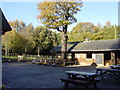
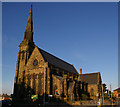


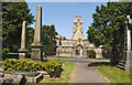
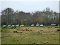
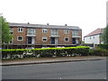
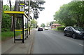

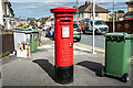
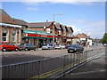
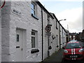
36 photos from this area
Area Information
Key information about the CH41 0DN including its size, population, and administrative classification.
- Area Type
- Postcode
- Area Size
- 4745 m²
- Population
- 1525
- Population Density
- 4450 people/km²
House Prices in CH41 0DN
29
Properties
£91,822
Average Sold Price
£31,000
Lowest Price
£158,500
Highest Price
Showing 29 properties
| Address | Type | Beds | Baths | Last Sale Price | Last Sale Date | |
|---|---|---|---|---|---|---|
| 41 Woodsorrel Road, Claughton, CH41 0DN | house | - | - | £158,500 | Sep 2025 | |
| 31 Woodsorrel Road, Claughton, CH41 0DN | Terraced | 3 | - | £150,000 | Feb 2025 | |
| 9 Woodsorrel Road, Claughton, CH41 0DN | Terraced | 3 | 1 | £157,000 | Oct 2024 | |
| 27 Woodsorrel Road, Claughton, CH41 0DN | Terraced | 3 | 1 | £140,000 | Jun 2024 | |
| 5 Woodsorrel Road, Claughton, CH41 0DN | Terraced | 3 | - | £148,000 | Sep 2021 | |
| 3 Woodsorrel Road, Claughton, CH41 0DN | house | - | - | £93,500 | May 2021 | |
| 47 Woodsorrel Road, Claughton, CH41 0DN | Terraced | 3 | 1 | £90,500 | Dec 2019 | |
| 19 Woodsorrel Road, Claughton, CH41 0DN | Terraced | 3 | 1 | £110,000 | Dec 2016 | |
| 49 Woodsorrel Road, Claughton, CH41 0DN | Terraced | 3 | 1 | £110,000 | Oct 2016 | |
| 51 Woodsorrel Road, Claughton, CH41 0DN | house | - | - | £82,000 | Dec 2013 |
Page 1 of 3
Energy Efficiency in CH41 0DN
Amenities
Schools
| Rank | School | Type | Entry gender | Ages |
|---|
Explore more schools in this area
Go to Schools tabDemographics
Household Size
Two person
most common
Accommodation Type
Houses
most common
Tenure
77
majority
Ethnic Group
White
most common
Religion
N/A
most common
Household Composition
N/A
most common
Age
47
median
Adults (30-64 years)
most common
Household Deprivation
N/A
with no deprivation
NS-SEC
38
in Lower managerial occupations
Explore more demographic insights in this area
Go to Demographics tabPlanning
Planning Constraints
- Flood RiskPremium
- Ramsar Wetland SitesPremium
- Area of Outstanding Natural BeautyPremium
- Protected Nature ReservePremium
- Protected WoodlandPremium