Area Overview for CH41 0AZ
Photos of CH41 0AZ


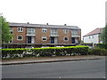
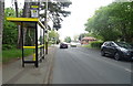

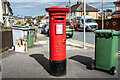
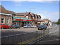
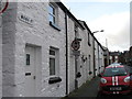
36 photos from this area
Area Information
Key information about the CH41 0AZ including its size, population, and administrative classification.
- Area Type
- Postcode
- Area Size
- 5800 m²
- Population
- 1594
- Population Density
- 8663 people/km²
House Prices in CH41 0AZ
17
Properties
£73,889
Average Sold Price
£33,000
Lowest Price
£108,000
Highest Price
Showing 17 properties
| Address | Type | Beds | Baths | Last Sale Price | Last Sale Date | |
|---|---|---|---|---|---|---|
| 38 Norman Street, Birkenhead, CH41 0AZ | Terraced | 3 | 1 | £108,000 | Jan 2024 | |
| 70 Norman Street, Birkenhead, CH41 0AZ | Semi-detached | 3 | 1 | £85,000 | Jul 2020 | |
| 54 Norman Street, Birkenhead, CH41 0AZ | Detached | 3 | 1 | £72,000 | Oct 2014 | |
| 50 Norman Street, Birkenhead, CH41 0AZ | house | - | - | £106,000 | Oct 2007 | |
| 62 Norman Street, Birkenhead, CH41 0AZ | Semi-detached | 3 | 1 | £53,040 | Jul 2007 | |
| 42 Norman Street, Birkenhead, CH41 0AZ | Terraced | - | - | £84,950 | May 2005 | |
| 40 Norman Street, Birkenhead, CH41 0AZ | Terraced | - | - | £89,950 | Dec 2004 | |
| 44 Norman Street, Birkenhead, CH41 0AZ | house | - | - | £72,950 | Jun 2004 | |
| 48 Norman Street, Birkenhead, CH41 0AZ | Terraced | - | - | £34,000 | May 1997 | |
| 58 Norman Street, Birkenhead, CH41 0AZ | house | - | - | £33,000 | Feb 1995 |
Page 1 of 2
Energy Efficiency in CH41 0AZ
Amenities
Schools
| Rank | School | Type | Entry gender | Ages |
|---|
Explore more schools in this area
Go to Schools tabDemographics
Household Size
One person
most common
Accommodation Type
Houses
most common
Tenure
52
majority
Ethnic Group
White
most common
Religion
N/A
most common
Household Composition
N/A
most common
Age
47
median
Adults (30-64 years)
most common
Household Deprivation
N/A
with no deprivation
NS-SEC
18
in Lower managerial occupations
Explore more demographic insights in this area
Go to Demographics tabPlanning
Planning Constraints
- Flood RiskPremium
- Ramsar Wetland SitesPremium
- Area of Outstanding Natural BeautyPremium
- Protected Nature ReservePremium
- Protected WoodlandPremium