Area Overview for CH4 8JW
Photos of CH4 8JW
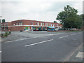
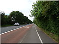
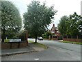
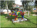
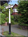
9 photos from this area
Area Information
Key information about the CH4 8JW including its size, population, and administrative classification.
- Area Type
- Postcode
- Area Size
- 6.2 hectares
- Population
- 1545
- Population Density
- 1246 people/km²
House Prices in CH4 8JW
58
Properties
£336,289
Average Sold Price
£122,000
Lowest Price
£655,000
Highest Price
Showing 58 properties
| Address | Type | Beds | Baths | Last Sale Price | Last Sale Date | |
|---|---|---|---|---|---|---|
| 3 The Hamlet, Chester, CH4 8JW | Detached | 5 | 3 | £655,000 | Sep 2020 | |
| Selber House, 82A Hough Green, Chester, CH4 8JW | Semi-detached | 4 | 4 | £635,000 | Oct 2013 | |
| 1 The Hamlet, Chester, CH4 8JW | Detached | 6 | 3 | £625,000 | Sep 2008 | |
| 51 Hough Green, Chester, CH4 8JW | house | 5 | 2 | £412,500 | Sep 2007 | |
| 68 Hough Green, Chester, CH4 8JW | Semi-detached | - | - | £578,000 | Jul 2007 | |
| 84A Hough Green, Chester, CH4 8JW | Detached | - | - | £330,000 | Aug 2006 | |
| 82B Hough Green, Chester, CH4 8JW | Semi-detached | - | - | £295,000 | May 2006 | |
| Woodgate House, 113 Hough Green, Chester, CH4 8JW | Detached | - | - | £430,000 | Feb 2004 | |
| Croquet View, 65 Hough Green, Chester, CH4 8JW | Detached | 4 | 3 | £267,000 | Feb 2004 | |
| 119 Hough Green, Chester, CH4 8JW | house | - | - | £325,000 | Aug 2002 |
Page 1 of 6
Energy Efficiency in CH4 8JW
Amenities
Schools
| Rank | School | Type | Entry gender | Ages |
|---|
Explore more schools in this area
Go to Schools tabDemographics
Household Size
Two person
most common
Accommodation Type
Houses
most common
Tenure
85
majority
Ethnic Group
White
most common
Religion
N/A
most common
Household Composition
N/A
most common
Age
47
median
Adults (30-64 years)
most common
Household Deprivation
N/A
with no deprivation
NS-SEC
56
in Lower managerial occupations
Explore more demographic insights in this area
Go to Demographics tabPlanning
Planning Constraints
- Flood RiskPremium
- Ramsar Wetland SitesPremium
- Area of Outstanding Natural BeautyPremium
- Protected Nature ReservePremium
- Protected WoodlandPremium