Area Overview for CH4 8AN
Photos of CH4 8AN
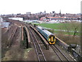


100 photos from this area
Area Information
Key information about the CH4 8AN including its size, population, and administrative classification.
- Area Type
- Postcode
- Area Size
- 1.8 hectares
- Population
- 1064
- Population Density
- 1876 people/km²
House Prices in CH4 8AN
21
Properties
£429,031
Average Sold Price
£93,500
Lowest Price
£875,000
Highest Price
Showing 21 properties
| Address | Type | Beds | Baths | Last Sale Price | Last Sale Date | |
|---|---|---|---|---|---|---|
| 3 Carrick Road, Chester, CH4 8AN | Detached | 4 | 3 | £750,000 | May 2025 | |
| 23 Carrick Road, Chester, CH4 8AN | house | 4 | 3 | £875,000 | Apr 2024 | |
| 37 Carrick Road, Chester, CH4 8AN | Detached | 4 | - | £665,000 | Jun 2020 | |
| 25 Carrick Road, Chester, CH4 8AN | house | - | - | £470,000 | Jul 2017 | |
| 39 Carrick Road, Chester, CH4 8AN | Detached | 4 | 2 | £425,000 | Jun 2014 | |
| 27 Carrick Road, Chester, CH4 8AN | Bungalow | 3 | - | £410,500 | Dec 2013 | |
| 13 Carrick Road, Chester, CH4 8AN | house | - | - | £430,000 | Apr 2011 | |
| 5 Carrick Road, Chester, CH4 8AN | house | - | - | £520,000 | Aug 2010 | |
| 35 Carrick Road, Chester, CH4 8AN | Detached | - | - | £370,000 | Dec 2007 | |
| 11 Carrick Road, Chester, CH4 8AN | Detached | - | - | £676,500 | Nov 2006 |
Page 1 of 3
Energy Efficiency in CH4 8AN
Amenities
Schools
| Rank | School | Type | Entry gender | Ages |
|---|
Explore more schools in this area
Go to Schools tabDemographics
Household Size
One person
most common
Accommodation Type
Houses
most common
Tenure
77
majority
Ethnic Group
White
most common
Religion
N/A
most common
Household Composition
N/A
most common
Age
47
median
Adults (30-64 years)
most common
Household Deprivation
N/A
with no deprivation
NS-SEC
52
in Lower managerial occupations
Explore more demographic insights in this area
Go to Demographics tabPlanning
Planning Constraints
- Flood RiskPremium
- Ramsar Wetland SitesPremium
- Area of Outstanding Natural BeautyPremium
- Protected Nature ReservePremium
- Protected WoodlandPremium