Area Overview for CH4 7RG
Photos of CH4 7RG
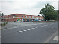
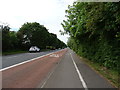
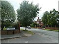
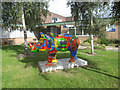
9 photos from this area
Area Information
Key information about the CH4 7RG including its size, population, and administrative classification.
- Area Type
- Postcode
- Area Size
- 1.4 hectares
- Population
- 1545
- Population Density
- 1246 people/km²
House Prices in CH4 7RG
21
Properties
£341,591
Average Sold Price
£124,500
Lowest Price
£575,000
Highest Price
Showing 21 properties
| Address | Type | Beds | Baths | Last Sale Price | Last Sale Date | |
|---|---|---|---|---|---|---|
| 20 Dennis Drive, Chester, CH4 7RG | house | - | - | £575,000 | Mar 2025 | |
| 14 Dennis Drive, Chester, CH4 7RG | Bungalow | 3 | 1 | £475,000 | Oct 2022 | |
| 2 Dennis Drive, Chester, CH4 7RG | Retail | 4 | 1 | £405,000 | Apr 2022 | |
| 16 Dennis Drive, Chester, CH4 7RG | Bungalow | - | - | £365,000 | Jan 2022 | |
| 5 Dennis Drive, Chester, CH4 7RG | Detached | 5 | 1 | £455,000 | Aug 2019 | |
| 4 Dennis Drive, Chester, CH4 7RG | house | - | - | £287,000 | Oct 2016 | |
| 10 Dennis Drive, Chester, CH4 7RG | Bungalow | - | - | £310,000 | Oct 2015 | |
| 6 Dennis Drive, Chester, CH4 7RG | Detached | 3 | - | £325,000 | Jul 2015 | |
| 19 Dennis Drive, Chester, CH4 7RG | Detached | - | - | £280,000 | Apr 2006 | |
| 11 Dennis Drive, Chester, CH4 7RG | Detached | - | - | £124,500 | Jun 1999 |
Page 1 of 3
Energy Efficiency in CH4 7RG
Amenities
Schools
| Rank | School | Type | Entry gender | Ages |
|---|
Explore more schools in this area
Go to Schools tabDemographics
Household Size
Two person
most common
Accommodation Type
Houses
most common
Tenure
85
majority
Ethnic Group
White
most common
Religion
N/A
most common
Household Composition
N/A
most common
Age
47
median
Adults (30-64 years)
most common
Household Deprivation
N/A
with no deprivation
NS-SEC
56
in Lower managerial occupations
Explore more demographic insights in this area
Go to Demographics tabPlanning
Planning Constraints
- Flood RiskPremium
- Ramsar Wetland SitesPremium
- Area of Outstanding Natural BeautyPremium
- Protected Nature ReservePremium
- Protected WoodlandPremium