Area Overview for CH4 7QE
Photos of CH4 7QE
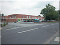
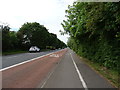
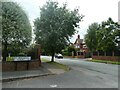
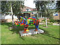
9 photos from this area
Area Information
Key information about the CH4 7QE including its size, population, and administrative classification.
- Area Type
- Postcode
- Area Size
- 7920 m²
- Population
- 1622
- Population Density
- 3426 people/km²
House Prices in CH4 7QE
19
Properties
£193,463
Average Sold Price
£47,000
Lowest Price
£385,000
Highest Price
Showing 19 properties
| Address | Type | Beds | Baths | Last Sale Price | Last Sale Date | |
|---|---|---|---|---|---|---|
| 27 Lower Field Road, Chester, CH4 7QE | house | - | - | £255,000 | Oct 2020 | |
| 15 Lower Field Road, Chester, CH4 7QE | house | - | - | £340,000 | Sep 2020 | |
| 1 Lower Field Road, Chester, CH4 7QE | Bungalow | 3 | 1 | £295,000 | Apr 2019 | |
| 37 Lower Field Road, Chester, CH4 7QE | Semi-detached | 3 | 1 | £207,000 | Sep 2016 | |
| 5 Lower Field Road, Chester, CH4 7QE | house | - | - | £385,000 | Jun 2016 | |
| 39 Lower Field Road, Chester, CH4 7QE | Detached | 4 | 1 | £272,000 | Oct 2013 | |
| 31 Lower Field Road, Chester, CH4 7QE | Semi-detached | 3 | - | £160,000 | Jun 2013 | |
| 25 Lower Field Road, Chester, CH4 7QE | house | - | - | £181,000 | Dec 2009 | |
| 11 Lower Field Road, Chester, CH4 7QE | Bungalow | - | - | £170,000 | Apr 2009 | |
| 29 Lower Field Road, Chester, CH4 7QE | Detached | 5 | 1 | £120,000 | Aug 2004 |
Page 1 of 2
Energy Efficiency in CH4 7QE
Amenities
Schools
| Rank | School | Type | Entry gender | Ages |
|---|
Explore more schools in this area
Go to Schools tabDemographics
Household Size
Two person
most common
Accommodation Type
Houses
most common
Tenure
90
majority
Ethnic Group
White
most common
Religion
N/A
most common
Household Composition
N/A
most common
Age
47
median
Adults (30-64 years)
most common
Household Deprivation
N/A
with no deprivation
NS-SEC
51
in Lower managerial occupations
Explore more demographic insights in this area
Go to Demographics tabPlanning
Planning Constraints
- Flood RiskPremium
- Ramsar Wetland SitesPremium
- Area of Outstanding Natural BeautyPremium
- Protected Nature ReservePremium
- Protected WoodlandPremium