Area Overview for CH3 9BH
Photos of CH3 9BH
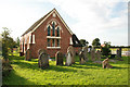
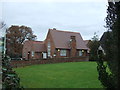
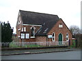
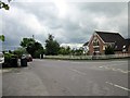
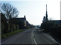
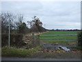
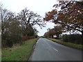
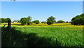
9 photos from this area
Area Information
Key information about the CH3 9BH including its size, population, and administrative classification.
- Area Type
- Postcode
- Area Size
- 2.0 km²
- Population
- 1697
- Population Density
- 48 people/km²
House Prices in CH3 9BH
17
Properties
£342,000
Average Sold Price
£200,000
Lowest Price
£650,000
Highest Price
Showing 17 properties
| Address | Type | Beds | Baths | Last Sale Price | Last Sale Date | |
|---|---|---|---|---|---|---|
| The Brents, Church Lane, Huxley, Chester, CH3 9BH | house | - | - | £650,000 | Jan 2018 | |
| School House, Church Lane, Huxley, Chester, CH3 9BH | house | - | - | £200,000 | Dec 2017 | |
| Sonning, Church Lane, Huxley, Chester, CH3 9BH | Detached | - | - | £335,000 | Jun 2005 | |
| The Cottage, Church Lane, Huxley, Chester, CH3 9BH | Bungalow | - | - | £235,000 | Apr 2003 | |
| Briarcroft, Church Lane, Huxley, Chester, CH3 9BH | Detached | 4 | - | £290,000 | Sep 1999 | |
| Gorse Farm, Church Lane, Huxley, Chester, CH3 9BH | Detached | 4 | 2 | - | - | |
| Playing Fields, Huxley Church Of England Primary School, Church Lane, Huxley, Chester, CH3 9BH | Leisure | - | - | - | - | |
| St Andrews, Church Lane, Huxley, Chester, CH3 9BH | house | - | - | - | - | |
| Yew Tree House, Church Lane, Huxley, Chester, CH3 9BH | Detached | - | - | - | - | |
| Laurel Bank, Church Lane, Huxley, Chester, CH3 9BH | house | - | - | - | - |
Page 1 of 2
Energy Efficiency in CH3 9BH
Amenities
Schools
| Rank | School | Type | Entry gender | Ages |
|---|
Explore more schools in this area
Go to Schools tabDemographics
Household Size
Two person
most common
Accommodation Type
Houses
most common
Tenure
78
majority
Ethnic Group
White
most common
Religion
N/A
most common
Household Composition
N/A
most common
Age
47
median
Adults (30-64 years)
most common
Household Deprivation
N/A
with no deprivation
NS-SEC
41
in Lower managerial occupations
Explore more demographic insights in this area
Go to Demographics tabPlanning
Planning Constraints
- Flood RiskPremium
- Ramsar Wetland SitesPremium
- Area of Outstanding Natural BeautyPremium
- Protected Nature ReservePremium
- Protected WoodlandPremium