Area Overview for CH3 8BH
Photos of CH3 8BH

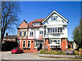
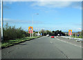
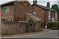

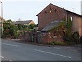
7 photos from this area
Area Information
Key information about the CH3 8BH including its size, population, and administrative classification.
- Area Type
- Postcode
- Area Size
- 69.2 hectares
- Population
- 1771
- Population Density
- 210 people/km²
House Prices in CH3 8BH
35
Properties
£292,995
Average Sold Price
£86,950
Lowest Price
£625,000
Highest Price
Showing 35 properties
| Address | Type | Beds | Baths | Last Sale Price | Last Sale Date | |
|---|---|---|---|---|---|---|
| Inglenook Cottage, Kelsall Road, Ashton Hayes, Chester, CH3 8BH | house | - | - | £300,000 | Sep 2021 | |
| Grouse Cottage, Kelsall Road, Ashton Hayes, Chester, CH3 8BH | Retail | 3 | 1 | £385,000 | Feb 2021 | |
| Lyndhurst Cottage, Kelsall Road, Ashton Hayes, Chester, CH3 8BH | house | - | - | £520,000 | Jan 2021 | |
| Pear Tree Cottage, Kelsall Road, Ashton Hayes, Chester, CH3 8BH | house | - | - | £625,000 | Dec 2017 | |
| Broom Cottage, Kelsall Road, Ashton Hayes, Chester, CH3 8BH | house | - | - | £305,000 | Dec 2011 | |
| Post Office View, Kelsall Road, Ashton Hayes, Chester, CH3 8BH | Terraced | 2 | - | £185,000 | Sep 2006 | |
| Pine Cottage, Kelsall Road, Ashton Hayes, Chester, CH3 8BH | Terraced | 2 | - | £214,000 | Apr 2006 | |
| Norcot, Kelsall Road, Ashton Hayes, Chester, CH3 8BH | house | - | - | £154,000 | Sep 2004 | |
| Ivydene, Kelsall Road, Ashton Hayes, Chester, CH3 8BH | Semi-detached | 4 | - | £155,000 | Jan 1999 | |
| Stone Haven, Kelsall Road, Ashton Hayes, Chester, CH3 8BH | Terraced | 2 | 1 | £86,950 | Dec 1998 |
Page 1 of 4
Energy Efficiency in CH3 8BH
Amenities
Schools
| Rank | School | Type | Entry gender | Ages |
|---|
Explore more schools in this area
Go to Schools tabDemographics
Household Size
Two person
most common
Accommodation Type
Houses
most common
Tenure
82
majority
Ethnic Group
White
most common
Religion
N/A
most common
Household Composition
N/A
most common
Age
47
median
Adults (30-64 years)
most common
Household Deprivation
N/A
with no deprivation
NS-SEC
47
in Lower managerial occupations
Explore more demographic insights in this area
Go to Demographics tabPlanning
Planning Constraints
- Flood RiskPremium
- Ramsar Wetland SitesPremium
- Area of Outstanding Natural BeautyPremium
- Protected Nature ReservePremium
- Protected WoodlandPremium