Area Overview for CH3 7QT
Photos of CH3 7QT
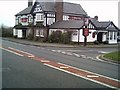
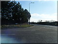
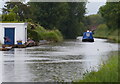
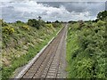
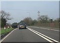
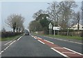

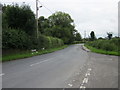
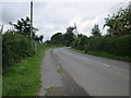
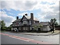
19 photos from this area
Area Information
Key information about the CH3 7QT including its size, population, and administrative classification.
- Area Type
- Postcode
- Area Size
- 24.8 hectares
- Population
- 2000
- Population Density
- 239 people/km²
House Prices in CH3 7QT
17
Properties
£387,536
Average Sold Price
£150,000
Lowest Price
£640,000
Highest Price
Showing 17 properties
| Address | Type | Beds | Baths | Last Sale Price | Last Sale Date | |
|---|---|---|---|---|---|---|
| 2 Common Lane, Waverton, Chester, CH3 7QT | house | - | - | £640,000 | Aug 2023 | |
| 18 Common Lane, Waverton, Chester, CH3 7QT | Bungalow | - | - | £446,000 | Oct 2021 | |
| 26 Common Lane, Waverton, Chester, CH3 7QT | house | - | - | £625,000 | Jun 2021 | |
| 4 Common Lane, Waverton, Chester, CH3 7QT | Detached | 4 | - | £499,950 | Nov 2013 | |
| 6 Common Lane, Waverton, Chester, CH3 7QT | house | - | - | £235,000 | Jul 2012 | |
| Clovelly, 10 Common Lane, Waverton, Chester, CH3 7QT | house | - | - | £267,000 | Jun 2010 | |
| 16 Common Lane, Waverton, Chester, CH3 7QT | house | - | - | £400,000 | Mar 2010 | |
| 24 Common Lane, Waverton, Chester, CH3 7QT | Detached | 4 | 2 | £385,000 | Apr 2006 | |
| 8 Common Lane, Waverton, Chester, CH3 7QT | Semi-detached | - | - | £219,950 | Feb 2004 | |
| 14 Common Lane, Waverton, Chester, CH3 7QT | Semi-detached | - | - | £150,000 | Dec 2003 |
Page 1 of 2
Energy Efficiency in CH3 7QT
Amenities
Schools
| Rank | School | Type | Entry gender | Ages |
|---|
Explore more schools in this area
Go to Schools tabDemographics
Household Size
Two person
most common
Accommodation Type
Houses
most common
Tenure
86
majority
Ethnic Group
White
most common
Religion
N/A
most common
Household Composition
N/A
most common
Age
47
median
Adults (30-64 years)
most common
Household Deprivation
N/A
with no deprivation
NS-SEC
49
in Lower managerial occupations
Explore more demographic insights in this area
Go to Demographics tabPlanning
Planning Constraints
- Flood RiskPremium
- Ramsar Wetland SitesPremium
- Area of Outstanding Natural BeautyPremium
- Protected Nature ReservePremium
- Protected WoodlandPremium