Area Overview for CH26 9AW
Photos of CH26 9AW

Area Information
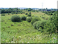
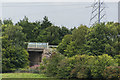
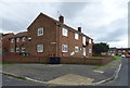
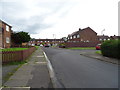
Living in CH26 9AW, part of Prenton in Wirral, offers a blend of historical roots and modern convenience. This small residential cluster, home to 1,473 people, sits on the east of the Wirral Peninsula, bordered by the M53 motorway to the west and contiguous with nearby areas like Oxton, Tranmere, and Rock Ferry. The area’s character stems from its rural origins, first noted in the Domesday Book as *Prestune*, with a legacy of woodland and water mills. Today, it is a quiet, established community with a strong sense of local identity. Residents benefit from proximity to multiple railway stations, ferry terminals, and retail hubs, while the area’s low crime rate and absence of environmental constraints make it appealing. The median age of 47 suggests a stable population, with many households owning their homes. Daily life here is shaped by easy access to transport networks and the charm of a small, tightly knit neighbourhood.
- Area Type
- Postcode
- Area Size
- Not available
- Population
- Not available
- Population Density
- Not available
The property market in CH26 9AW is characterised by high home ownership (88%) and a focus on houses rather than flats or apartments. This suggests a market skewed towards owner-occupied properties, with limited rental activity. The prevalence of houses indicates a preference for larger, more private homes, which may cater to families or those seeking space. However, the area’s small size means the housing stock is limited, and buyers may need to look beyond CH26 9AW itself for more options. The high home ownership rate also implies a stable market with little turnover, which can be advantageous for long-term investors. For buyers, this means competition for available properties, but the absence of planning constraints and environmental risks adds to the area’s appeal.
House Prices in CH26 9AW
No properties found in this postcode.
Energy Efficiency in CH26 9AW
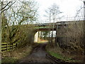
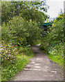
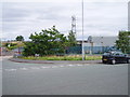
The lifestyle in CH26 9AW is shaped by its proximity to retail, transport, and leisure facilities. Nearby shops include Morrisons Daily Wirral, Morrisons Daily, and Asda Arrowe, providing essential grocery and retail services. Residents can access five railway stations, such as Green Lane and Rock Ferry, and three ferry terminals, including Birkenhead Ferry Terminal, which connect to nearby towns and cities. The area’s historical character is complemented by local landmarks like the Prenton War Memorial and the Halfway House public house, adding to its distinctiveness. These amenities support a convenient, community-oriented lifestyle, with easy access to both urban and rural settings. The combination of practical transport links and local amenities makes daily life in CH26 9AW efficient and varied.
Amenities
Schools
| Rank | School | Type | Entry gender | Ages |
|---|
Explore more schools in this area
Go to Schools tabDemographics
The community in CH26 9AW is predominantly composed of adults aged 30–64, with a median age of 47. This suggests a mature, established population, likely with long-term ties to the area. Home ownership is exceptionally high at 88%, indicating a stable housing market and a focus on long-term residency rather than rental turnover. The accommodation type is primarily houses, reflecting a residential profile that leans towards family homes and larger properties. The predominant ethnic group is White, though no specific data on diversity or deprivation is provided. The high home ownership rate and age demographics point to a community prioritising security and continuity, with fewer transient residents. This stability is reinforced by the area’s low crime risk and absence of environmental planning constraints, which may appeal to those seeking a predictable, low-stress living environment.
Household Size
Accommodation Type
Tenure
Ethnic Group
Religion
Household Composition
Age
Household Deprivation
NS-SEC
Explore more demographic insights in this area
Go to Demographics tabPlanning
Planning Constraints
- Flood RiskPremium
- Ramsar Wetland SitesPremium
- Area of Outstanding Natural BeautyPremium
- Protected Nature ReservePremium
- Protected WoodlandPremium