Area Overview for CH25 9EP
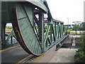
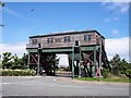
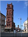
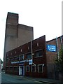
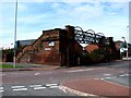
Photos of CH25 9EP


Area Information
Living in CH25 9EP means being part of a small, tightly knit residential cluster in the heart of Birkenhead and Tranmere, Wirral. With a population of just 1,022, this area retains a quiet, almost village-like character despite its proximity to urban amenities. Historically, Tranmere’s name derives from Old Norse, reflecting its coastal roots, and the area has long been shaped by its maritime and industrial past. Today, it balances historical charm with modern convenience. The postcode covers a compact zone where homes are predominantly houses, and the community is defined by its mature age profile, with residents largely aged 30–64. Daily life here is punctuated by the presence of nearby transport hubs, including ferry terminals and railway stations, which connect residents to Liverpool, Chester, and beyond. While the area lacks large-scale commercial developments, its proximity to retail outlets like Iceland and Asda ensures basic needs are met. The low flood risk and absence of protected natural sites make it a practical choice for those prioritising safety and ease of planning. However, the high crime risk reported in assessments demands careful consideration of security measures.
- Area Type
- Postcode
- Area Size
- Not available
- Population
- 1022
- Population Density
- 1235 people/km²
The property market in CH25 9EP is characterised by a low home ownership rate of 22%, which suggests that the area is primarily a rental market rather than one dominated by owner-occupied homes. The accommodation type is predominantly houses, which is notable for a small postcode area and may indicate a mix of semi-detached or terraced properties. This could appeal to families seeking more space than flats or apartments typically offer. However, the limited size of the area means that the housing stock is unlikely to be extensive, and buyers may need to look beyond CH25 9EP itself to find a wider selection of properties. The low home ownership rate also implies that the local economy may rely on external employment opportunities, as residents are more likely to commute than live in owner-occupied homes. For those considering purchase, the scarcity of available properties could drive up competition, particularly for homes in good condition.
House Prices in CH25 9EP
No properties found in this postcode.
Energy Efficiency in CH25 9EP
Life in CH25 9EP is shaped by its proximity to a range of amenities, including five ferry terminals, five railway stations, and five retail outlets. The ferry services, such as Woodside Birkenhead Ferry Terminal and Liverpool Isle of Man & Dublin Terminal, provide easy access to Liverpool and other destinations, while the railway stations—like Birkenhead Hamilton Square and Birkenhead Central—offer connections to Chester and beyond. Retail options include Iceland, Asda, and Heron Birkenhead, ensuring that everyday shopping needs are met without the need to travel far. While the area lacks detailed information on parks or leisure facilities, its historical sites, such as St Catherine’s Church and Tranmere Old Hall, add cultural depth to daily life. The mix of transport and retail amenities contributes to a practical, convenient lifestyle, though residents may need to venture further for more extensive leisure or recreational opportunities.
Amenities
Schools
The nearest school to CH25 9EP is Cathcart Street Primary School, a primary institution with an Ofsted rating of satisfactory. This school serves the local community, providing education for younger children within walking distance of many homes in the area. The presence of a primary school is a key factor for families, though the data does not indicate the availability of secondary schools or further education facilities nearby. The satisfactory rating suggests that while the school meets basic standards, there may be scope for improvement in areas such as teaching quality or student outcomes. Families with children may need to consider commuting to other parts of Wirral or Liverpool for secondary education, as no secondary schools are listed in the data. The limited range of school types in the area means that parents may need to look beyond CH25 9EP to access a broader spectrum of educational options.
| Rank | School | Type | Entry gender | Ages |
|---|
Explore more schools in this area
Go to Schools tabDemographics
CH25 9EP has a median age of 47, with the majority of residents falling within the 30–64 age range. This suggests a community of established professionals and families, rather than students or retirees. Home ownership in the area is low at 22%, indicating that most residents rent their homes. The accommodation type is primarily houses, which is unusual for a postcode of this size, suggesting a mix of older properties and smaller family homes. The predominant ethnic group is White, reflecting the area’s historical demographics and limited recent migration. The low home ownership rate may imply a rental market dominated by private landlords or housing associations. With a population of just 1,022, the area is small enough to foster a close-knit community but not so large as to feel anonymous. However, the absence of detailed data on deprivation or income levels means it is difficult to assess how this affects quality of life beyond the basic statistics provided.
Household Size
Accommodation Type
Tenure
Ethnic Group
Religion
Household Composition
Age
Household Deprivation
NS-SEC
Explore more demographic insights in this area
Go to Demographics tabPlanning
Planning Constraints
- Flood RiskPremium
- Ramsar Wetland SitesPremium
- Area of Outstanding Natural BeautyPremium
- Protected Nature ReservePremium
- Protected WoodlandPremium