Area Overview for CH2 4DJ
Photos of CH2 4DJ
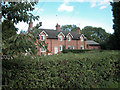
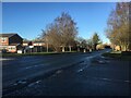
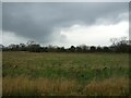
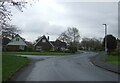
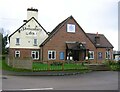
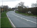
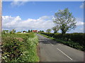
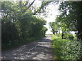
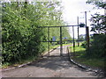
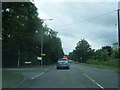
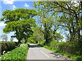
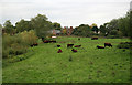
27 photos from this area
Area Information
Key information about the CH2 4DJ including its size, population, and administrative classification.
- Area Type
- Postcode
- Area Size
- 9737 m²
- Population
- 1073
- Population Density
- 127 people/km²
House Prices in CH2 4DJ
17
Properties
£265,591
Average Sold Price
£123,000
Lowest Price
£435,000
Highest Price
Showing 17 properties
| Address | Type | Beds | Baths | Last Sale Price | Last Sale Date | |
|---|---|---|---|---|---|---|
| 12 Dane Grove, Mickle Trafford, Chester, CH2 4DJ | house | 4 | 1 | £268,000 | Feb 2025 | |
| Pol Scathow, 3 Dane Grove, Mickle Trafford, Chester, CH2 4DJ | Bungalow | 3 | 1 | £435,000 | Sep 2024 | |
| 7 Dane Grove, Mickle Trafford, Chester, CH2 4DJ | house | - | - | £325,000 | Jul 2023 | |
| 22 Dane Grove, Mickle Trafford, Chester, CH2 4DJ | Detached | 4 | 2 | £370,000 | Aug 2022 | |
| 1 Dane Grove, Mickle Trafford, Chester, CH2 4DJ | Bungalow | 3 | 1 | £300,000 | Dec 2020 | |
| 18 Dane Grove, Mickle Trafford, Chester, CH2 4DJ | house | 3 | 1 | £230,000 | Jul 2017 | |
| 9 Dane Grove, Mickle Trafford, Chester, CH2 4DJ | Detached | 4 | 1 | £248,000 | Aug 2016 | |
| 20 Dane Grove, Mickle Trafford, Chester, CH2 4DJ | Semi-detached | 3 | - | £215,000 | May 2015 | |
| 5 Dane Grove, Mickle Trafford, Chester, CH2 4DJ | house | 4 | - | £212,500 | Jan 2012 | |
| 10 Dane Grove, Mickle Trafford, Chester, CH2 4DJ | Semi-detached | 3 | 2 | £195,000 | Mar 2006 |
Page 1 of 2
Energy Efficiency in CH2 4DJ
Amenities
Schools
| Rank | School | Type | Entry gender | Ages |
|---|
Explore more schools in this area
Go to Schools tabDemographics
Household Size
Two person
most common
Accommodation Type
Houses
most common
Tenure
93
majority
Ethnic Group
White
most common
Religion
N/A
most common
Household Composition
N/A
most common
Age
47
median
Adults (30-64 years)
most common
Household Deprivation
N/A
with no deprivation
NS-SEC
51
in Lower managerial occupations
Explore more demographic insights in this area
Go to Demographics tabPlanning
Planning Constraints
- Flood RiskPremium
- Ramsar Wetland SitesPremium
- Area of Outstanding Natural BeautyPremium
- Protected Nature ReservePremium
- Protected WoodlandPremium