Area Overview for CH2 4BT
Photos of CH2 4BT
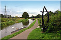
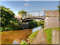
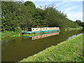
![Caughall Bridge [no 134], from the south-west in CH2 4BT](https://images.propbar.co.uk/images/geograph/75/59/7559727_120.jpg)
36 photos from this area
Area Information
Key information about the CH2 4BT including its size, population, and administrative classification.
- Area Type
- Postcode
- Area Size
- 13.2 hectares
- Population
- 1285
- Population Density
- 79 people/km²
House Prices in CH2 4BT
7
Properties
-
Average Sold Price
-
Lowest Price
-
Highest Price
Showing 7 properties
| Address | Type | Beds | Baths | Last Sale Price | Last Sale Date | |
|---|---|---|---|---|---|---|
| Strategic Marine Services, 12A, Chapel Court, Wervin Road, Wervin, Chester, CH2 4BT | Office | - | - | - | - | |
| 12, Chapel Court, Wervin Road, Wervin, Chester, CH2 4BT | office_workshop | - | - | - | - | |
| Castree Ltd, 3, Chapel Court, Wervin Road, Wervin, Chester, CH2 4BT | Office | - | - | - | - | |
| 11, Chapel Court, Wervin Road, Wervin, Chester, CH2 4BT | office_workshop | - | - | - | - | |
| Lower Barn, Chapel Court, Wervin Road, Wervin, Chester, CH2 4BT | Detached | - | - | - | - | |
| Unit D8 - 9, Chapel Court, Wervin Road, Wervin, Chester, CH2 4BT | office_workshop | - | - | - | - | |
| Noiseair Ltd, 14A, Chapel Court, Wervin Road, Wervin, Chester, CH2 4BT | Office | - | - | - | - |
Energy Efficiency in CH2 4BT
Amenities
Schools
| Rank | School | Type | Entry gender | Ages |
|---|
Explore more schools in this area
Go to Schools tabDemographics
Household Size
Two person
most common
Accommodation Type
Houses
most common
Tenure
80
majority
Ethnic Group
White
most common
Religion
N/A
most common
Household Composition
N/A
most common
Age
47
median
Adults (30-64 years)
most common
Household Deprivation
N/A
with no deprivation
NS-SEC
29
in Lower managerial occupations
Explore more demographic insights in this area
Go to Demographics tabPlanning
Planning Constraints
- Flood RiskPremium
- Ramsar Wetland SitesPremium
- Area of Outstanding Natural BeautyPremium
- Protected Nature ReservePremium
- Protected WoodlandPremium