Area Overview for CH2 3PT
Photos of CH2 3PT
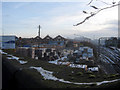
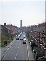
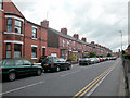
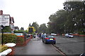
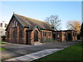
100 photos from this area
Area Information
Key information about the CH2 3PT including its size, population, and administrative classification.
- Area Type
- Postcode
- Area Size
- 2121 m²
- Population
- 1432
- Population Density
- 5489 people/km²
House Prices in CH2 3PT
17
Properties
£144,433
Average Sold Price
£28,000
Lowest Price
£255,000
Highest Price
Showing 17 properties
| Address | Type | Beds | Baths | Last Sale Price | Last Sale Date | |
|---|---|---|---|---|---|---|
| 110 West Street, Chester, CH2 3PT | Terraced | 2 | 1 | £215,000 | Aug 2025 | |
| 112 West Street, Chester, CH2 3PT | Terraced | 2 | 1 | £255,000 | Jul 2025 | |
| 90 West Street, Chester, CH2 3PT | Terraced | 2 | - | £230,000 | Oct 2023 | |
| 92 West Street, Chester, CH2 3PT | house | 3 | - | £182,000 | Feb 2023 | |
| 88 West Street, Chester, CH2 3PT | house | - | - | £235,000 | Jul 2022 | |
| 84 West Street, Chester, CH2 3PT | house | 2 | 1 | £170,000 | Nov 2020 | |
| 108 West Street, Chester, CH2 3PT | Terraced | 2 | 1 | £175,000 | Aug 2019 | |
| 102 West Street, Chester, CH2 3PT | Terraced | 2 | 1 | £174,000 | Mar 2016 | |
| 106 West Street, Chester, CH2 3PT | Terraced | - | - | £162,000 | Apr 2008 | |
| 98 West Street, Chester, CH2 3PT | Terraced | 2 | 1 | £125,000 | Jul 2004 |
Page 1 of 2
Energy Efficiency in CH2 3PT
Amenities
Schools
| Rank | School | Type | Entry gender | Ages |
|---|
Explore more schools in this area
Go to Schools tabDemographics
Household Size
Family (3-5 people)
most common
Accommodation Type
Houses
most common
Tenure
63
majority
Ethnic Group
White
most common
Religion
N/A
most common
Household Composition
N/A
most common
Age
47
median
Adults (30-64 years)
most common
Household Deprivation
N/A
with no deprivation
NS-SEC
44
in Lower managerial occupations
Explore more demographic insights in this area
Go to Demographics tabPlanning
Planning Constraints
- Flood RiskPremium
- Ramsar Wetland SitesPremium
- Area of Outstanding Natural BeautyPremium
- Protected Nature ReservePremium
- Protected WoodlandPremium