Area Overview for CH2 3EZ
Photos of CH2 3EZ
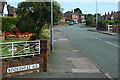
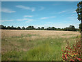
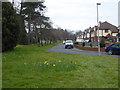
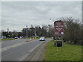

51 photos from this area
Area Information
Key information about the CH2 3EZ including its size, population, and administrative classification.
- Area Type
- Postcode
- Area Size
- 2.7 hectares
- Population
- 1382
- Population Density
- 5706 people/km²
House Prices in CH2 3EZ
26
Properties
£229,898
Average Sold Price
£76,000
Lowest Price
£330,000
Highest Price
Showing 26 properties
| Address | Type | Beds | Baths | Last Sale Price | Last Sale Date | |
|---|---|---|---|---|---|---|
| 38 Crossley Crescent, Chester, CH2 3EZ | house | - | - | £330,000 | Jun 2023 | |
| 46 Crossley Crescent, Chester, CH2 3EZ | house | - | - | £291,670 | Aug 2021 | |
| 8 Crossley Crescent, Chester, CH2 3EZ | Semi-detached | 3 | 1 | £323,000 | Sep 2020 | |
| 48 Crossley Crescent, Chester, CH2 3EZ | house | - | - | £255,000 | Aug 2020 | |
| 44 Crossley Crescent, Chester, CH2 3EZ | house | 3 | - | £270,000 | Jun 2019 | |
| 20 Crossley Crescent, Chester, CH2 3EZ | house | 3 | - | £260,000 | Aug 2018 | |
| 14 Crossley Crescent, Chester, CH2 3EZ | Semi-detached | 3 | 1 | £270,000 | Feb 2017 | |
| 36 Crossley Crescent, Chester, CH2 3EZ | house | - | - | £257,500 | Aug 2016 | |
| 12 Crossley Crescent, Chester, CH2 3EZ | house | - | - | £257,400 | Dec 2014 | |
| 2 Crossley Crescent, Chester, CH2 3EZ | house | - | - | £246,500 | Jul 2014 |
Page 1 of 3
Energy Efficiency in CH2 3EZ
Amenities
Schools
| Rank | School | Type | Entry gender | Ages |
|---|
Explore more schools in this area
Go to Schools tabDemographics
Household Size
Two person
most common
Accommodation Type
Houses
most common
Tenure
56
majority
Ethnic Group
White
most common
Religion
N/A
most common
Household Composition
N/A
most common
Age
47
median
Adults (30-64 years)
most common
Household Deprivation
N/A
with no deprivation
NS-SEC
28
in Lower managerial occupations
Explore more demographic insights in this area
Go to Demographics tabPlanning
Planning Constraints
- Flood RiskPremium
- Ramsar Wetland SitesPremium
- Area of Outstanding Natural BeautyPremium
- Protected Nature ReservePremium
- Protected WoodlandPremium