Area Overview for CH2 3AR
Photos of CH2 3AR
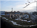
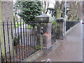
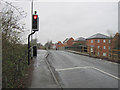
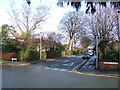
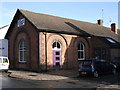
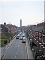
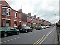
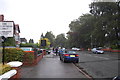
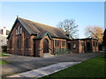
100 photos from this area
Area Information
Key information about the CH2 3AR including its size, population, and administrative classification.
- Area Type
- Postcode
- Area Size
- 7521 m²
- Population
- Not available
- Population Density
- Not available
House Prices in CH2 3AR
68
Properties
£147,043
Average Sold Price
£35,000
Lowest Price
£307,500
Highest Price
Showing 68 properties
| Address | Type | Beds | Baths | Last Sale Price | Last Sale Date | |
|---|---|---|---|---|---|---|
| 165 Westminster Road, Chester, CH2 3AR | Terraced | 3 | 1 | £217,000 | Jul 2025 | |
| 99 Westminster Road, Chester, CH2 3AR | Terraced | 2 | 1 | £190,000 | Mar 2025 | |
| 119 Westminster Road, Chester, CH2 3AR | Terraced | 2 | 1 | £229,950 | Jan 2025 | |
| 69 Westminster Road, Chester, CH2 3AR | house | 2 | 1 | £199,950 | Aug 2024 | |
| 173 Westminster Road, Chester, CH2 3AR | Terraced | 1 | 1 | £165,500 | Nov 2022 | |
| 141 Westminster Road, Chester, CH2 3AR | Terraced | 2 | - | £192,000 | Feb 2022 | |
| 117 Westminster Road, Chester, CH2 3AR | Terraced | 2 | 1 | £206,500 | Nov 2021 | |
| 161 Westminster Road, Chester, CH2 3AR | house | - | - | £207,000 | May 2021 | |
| 65 Westminster Road, Chester, CH2 3AR | Terraced | 2 | 1 | £184,000 | May 2021 | |
| 81 Westminster Road, Chester, CH2 3AR | house | - | - | £238,000 | Apr 2021 |
Page 1 of 7
Energy Efficiency in CH2 3AR
Amenities
Schools
| Rank | School | Type | Entry gender | Ages |
|---|
Explore more schools in this area
Go to Schools tabDemographics
Household Size
Two person
most common
Accommodation Type
Houses
most common
Tenure
62
majority
Ethnic Group
White
most common
Religion
N/A
most common
Household Composition
N/A
most common
Age
47
median
Adults (30-64 years)
most common
Household Deprivation
N/A
with no deprivation
NS-SEC
52
in Lower managerial occupations
Explore more demographic insights in this area
Go to Demographics tabPlanning
Planning Constraints
- Flood RiskPremium
- Ramsar Wetland SitesPremium
- Area of Outstanding Natural BeautyPremium
- Protected Nature ReservePremium
- Protected WoodlandPremium