Area Overview for CH2 3AE
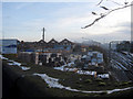
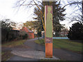
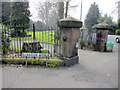
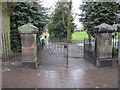
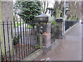
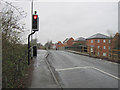
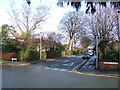
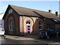
Photos of CH2 3AE
Area Information
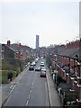
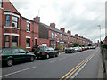
Living in CH2 3AE means residing within a tight residential cluster of 2.5 hectares in the Newton and Hoole ward of Chester. This specific postcode area contains a small population of 1,528 people, creating an intimate neighbourhood feel within the broader Cheshire village city. The location sits in the North West of England, combining historical significance with modern convenience. The settlement first appeared in records in 1119, but the area's character was largely shaped during the Industrial Revolution when railways and canals drove rapid expansion. Today, the district remains primarily suburban and residential, defined by Victorian and interwar housing stock. You are stepping into a community where the ground itself tells a story. Newton Hollows, a historic Roman roadway that eventually sank into a distinct hollow, runs through the heart of the area. Regenerated in 2007 with interpretive signage regarding its origins between 79 CE and 385 CE, this 506-metre public footpath serves as a central landmark. The area was historically known as "The Valley of the Demons" in the mid-12th century due to bandit activity along this route. As you explore homes in CH2 3AE, you are walking on ground that once served as a main thoroughfare for civil traffic and livestock for over a thousand years. The Ermine Public House now stands where the fraternity of St. Anne's erected a protective cross in medieval times. This specific postcode represents a blend of deep heritage and functional suburban living in Chester.
- Area Type
- Postcode
- Area Size
- 2.5 hectares
- Population
- 1528
- Population Density
- 5341 people/km²
The property market in CH2 3AE is defined by a specific housing stock and ownership pattern. Houses dominate the accommodation type within this postcode, aligning with the Victorian and interwar character of the Newton and Hoole ward. Only 34% of residents own their homes, which distinguishes this area from regions with significantly higher ownership rates. This statistic indicates a substantial rental component, making the area attractive to those seeking to rent or buy-to-rent opportunities rather than a purely owner-occupied demographic. The low population of 1,528 across such a small 2.5-hectare site further limits the total number of available properties. You are looking at a micro-market where supply is inherently constrained. The area's history of rapid expansion during the Industrial Revolution provided the bulk of this existing housing supply, meaning the stock is not new. This context helps you understand the condition and age of most homes in CH2 3AE. Buyers should expect to find properties built in the 19th and early 20th centuries, consistent with the description of Victorian and interwar development. The presence of local shopping streets and public amenities nearby supports residential living without requiring a car for daily essentials. While the market is small, the historical significance of the location, including the Newton Hollows landmark, adds a layer of prestige not entirely captured by standard price indices. The area represents a niche glimpse into Chester's suburban evolution.
House Prices in CH2 3AE
Showing 92 properties
| Address | Type | Beds | Baths | Last Sale Price | Last Sale Date | |
|---|---|---|---|---|---|---|
| 31 Thomas Brassey Close, Chester, CH2 3AE | Flat | - | - | £180,000 | Aug 2025 | |
| 93 Thomas Brassey Close, Chester, CH2 3AE | Flat | 3 | 2 | £185,000 | May 2025 | |
| 55 Thomas Brassey Close, Chester, CH2 3AE | Flat | 3 | 1 | £179,750 | Apr 2025 | |
| 85 Thomas Brassey Close, Chester, CH2 3AE | Flat | - | - | £165,000 | Dec 2024 | |
| 81 Thomas Brassey Close, Chester, CH2 3AE | Flat | - | - | £175,000 | Oct 2024 | |
| 26 Thomas Brassey Close, Chester, CH2 3AE | Flat | - | - | £190,000 | May 2024 | |
| 5 Thomas Brassey Close, Chester, CH2 3AE | Flat | 2 | 1 | £155,000 | Nov 2023 | |
| 25 Thomas Brassey Close, Chester, CH2 3AE | Flat | 3 | 1 | £182,500 | Oct 2023 | |
| 8 Thomas Brassey Close, Chester, CH2 3AE | Flat | - | - | £155,000 | Feb 2023 | |
| 27 Thomas Brassey Close, Chester, CH2 3AE | Flat | - | - | £187,500 | Aug 2022 |
Energy Efficiency in CH2 3AE
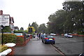
Daily life in CH2 3AE is defined by immediate access to essential amenities without the need for long journeys. Five retail locations are within practical reach, including Co-op Chester, Sainsburys Chester, and Waitrose Chester. These venues provide comprehensive food and grocery needs close to home. Five railway stations serve the broader area, with Chester Railway Station standing prominently among them. Five hours of train travel is not the metric here; rather, five accessible rail points facilitate flexible commutes and leisure trips. One airport, Hawarden Airport, adds regional mobility options for residents. The character of the area revolves around these local shopping streets and public amenities mentioned in the ward description. The Ermine Public House marks a significant historical point on Newton Hollows, offering a traditional pub atmosphere for leisure. The Millennium Greenway runs adjacent to the historic hollow, creating a green corridor for walking and cycling. You do not need to leave the neighbourhood to find a supermarket or a railway station. The area balances urban convenience with the quiet of a residential cluster. Shops and transport hubs are integrated into the fabric of the ward, supporting a lifestyle that values convenience.
Amenities
Schools
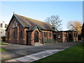
Family life in CH2 3AE benefits from access to highly rated educational institutions nearby. St Werburgh's and St Columba's Catholic Primary School stands as the local primary option, holding a Good rating from Ofsted. This school serves children in the immediate vicinity before they transition to secondary education. For older students, St Martin's Academy Chester is the designated secondary institution. This academy has achieved an Outstanding rating from Ofsted, placing it among the top-performing schools in the nation. The combination of a Good primary school and an Outstanding academy provides a strong educational pathway for families living in the ward. Parents can expect a seamless transition from local primary education to high-standard secondary schooling without moving districts. The presence of these two specific facilities means that families in CH2 3AE do not need to commute far for education. St Martin's Academy coverage is extensive, serving a large catchment area that certainly encompasses this postcode. St Werburgh's and St Columba's offers a Catholic ethos within the primary sector. This mix of specialisms and high performance ratings makes Newton and Hoole a practical choice for households prioritising academic quality.
| Rank | School | Type | Entry gender | Ages |
|---|
Explore more schools in this area
Go to Schools tabDemographics
The community in CH2 3AE reflects a relatively settled urban environment. The median age for residents is 47, with the most common age range falling between 30 and 64 years. This demographic profile suggests a population dominated by working-age adults rather than young people or retirees. Home ownership stands at 34%, indicating that slightly more than a third of households own their property outright or with a mortgage. The remaining majority likely rents, shaping the rental market dynamics in this small postcode. Accommodation types in CH2 3AE consist primarily of houses, fitting the description of a suburban ward rather than a high-rise urban block. The predominant ethnic group is White, reflecting the broader demographic trends of the Chester region. With a population density of 62,327 people per square kilometre, the area feels compact despite its modest 2.5-hectare size. This density is typical for established residential zones within city boundaries. The age structure implies a stable community where families and established professionals form the backbone of the local economy. Residents are likely engaged in local careers or commuting to central Chester, given the mature age profile. The mix of owner-occupied and rented housing suggests a balanced market appeal for different types of buyers seeking a foothold in this established ward.
Household Size
Accommodation Type
Tenure
Ethnic Group
Religion
Household Composition
Age
Household Deprivation
NS-SEC
Explore more demographic insights in this area
Go to Demographics tabPlanning
Planning Constraints
- Flood RiskPremium
- Ramsar Wetland SitesPremium
- Area of Outstanding Natural BeautyPremium
- Protected Nature ReservePremium
- Protected WoodlandPremium