Area Overview for CH2 2WD
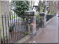
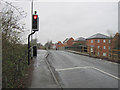
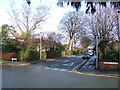
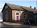
Photos of CH2 2WD
Area Information
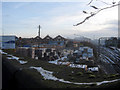
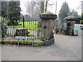
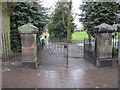
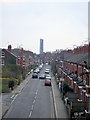
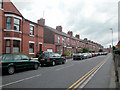
Living in CH2 2WD means being part of a small, tightly knit residential cluster in Chester, Cheshire. With a population of 1,541, the area retains a suburban, residential character shaped by Victorian and interwar housing. Nestled in the North West of England, it sits near the historic Newton Hollows, a 506-metre ancient Roman pathway designated as a public footpath. The area’s proximity to Chester’s city centre offers access to its cultural and commercial hubs while maintaining a quieter, community-focused atmosphere. Local landmarks include the Ermine Public House, built on the site of a medieval cross, and Hoole House, a 18th-century structure. The ward’s history as a former urban district adds layers of heritage, with Hoole Road serving as a key thoroughfare since the 19th century. Residents benefit from nearby rail links, including Chester Railway Station, and a mix of local shops and amenities. The area’s blend of historical significance and modern convenience makes it appealing for those seeking a stable, family-oriented environment.
- Area Type
- Postcode
- Area Size
- Not available
- Population
- 1541
- Population Density
- 4519 people/km²
CH2 2WD is predominantly an owner-occupied area, with 89% of homes owned by residents rather than rented. The accommodation type is primarily houses, reflecting the suburban nature of the ward and its historical development during the 19th and early 20th centuries. This housing stock suggests a focus on family homes with gardens, typical of Victorian and interwar architecture. The high home ownership rate indicates a stable market with limited rental activity, which may appeal to buyers seeking long-term investment or a place to settle. Given the area’s small size and proximity to Chester, property values are likely influenced by its historical character and transport links. Buyers should consider the limited availability of flats or modern housing, as the area’s stock is largely traditional. The mix of heritage and practicality makes it suitable for those prioritising space and stability.
House Prices in CH2 2WD
No properties found in this postcode.
Energy Efficiency in CH2 2WD
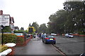
Residents of CH2 2WD have access to a range of nearby amenities, including five retail venues such as Morrisons Daily, Co-op Chester, and Heron Coniston, ensuring daily shopping needs are met. The area’s rail network, with five stations including Chester Railway Station, provides convenient transport links to the city and beyond. The historic Newton Hollows, a public footpath, offers a scenic walk with Roman-era origins, adding cultural value to daily life. The Ermine Public House, located near the former medieval cross, provides a local gathering spot. These amenities contribute to a balanced lifestyle, combining practicality with historical interest. The proximity to Chester’s city centre also opens up access to broader leisure, dining, and cultural opportunities, enhancing the area’s appeal.
Amenities
Schools
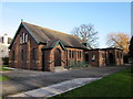
The nearest school to CH2 2WD is Newton Primary School, a primary institution with an Ofsted rating of satisfactory. This school serves the local community, offering education for younger children in the area. The absence of secondary schools nearby means families may need to look further afield for secondary education, though Chester’s city centre provides access to a range of schools. The presence of a primary school within practical reach supports families with young children, reducing the need for long commutes. However, the single school listed in the data highlights a limited choice for parents seeking multiple educational options. The satisfactory rating indicates that the school meets basic standards but may not excel in areas such as academic performance or extracurricular offerings.
| Rank | School | Type | Entry gender | Ages |
|---|
Explore more schools in this area
Go to Schools tabDemographics
CH2 2WD has a median age of 47, with the majority of residents aged between 30 and 64 years. This suggests a community of established professionals and families, reflecting the area’s suburban character. Home ownership is high at 89%, indicating a strong presence of long-term residents and a stable housing market. The predominant accommodation type is houses, aligning with the area’s residential focus. The predominant ethnic group is White, though specific data on diversity is not provided. The age profile and ownership figures suggest a mature, settled population with lower turnover. This demographic structure supports a community-oriented environment, where local amenities and schools are likely to cater to the needs of families and older residents. The absence of detailed diversity statistics means the area’s social composition remains largely unexplored in public records.
Household Size
Accommodation Type
Tenure
Ethnic Group
Religion
Household Composition
Age
Household Deprivation
NS-SEC
Explore more demographic insights in this area
Go to Demographics tabPlanning
Planning Constraints
- Flood RiskPremium
- Ramsar Wetland SitesPremium
- Area of Outstanding Natural BeautyPremium
- Protected Nature ReservePremium
- Protected WoodlandPremium