Area Overview for CH2 2LW
Photos of CH2 2LW
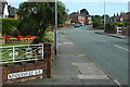
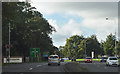
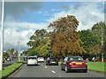
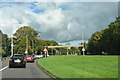
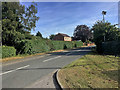
51 photos from this area
Area Information
Key information about the CH2 2LW including its size, population, and administrative classification.
- Area Type
- Postcode
- Area Size
- 5977 m²
- Population
- Not available
- Population Density
- Not available
House Prices in CH2 2LW
17
Properties
£132,392
Average Sold Price
£71,188
Lowest Price
£221,000
Highest Price
Showing 17 properties
| Address | Type | Beds | Baths | Last Sale Price | Last Sale Date | |
|---|---|---|---|---|---|---|
| 142 Kingsway, Chester, CH2 2LW | Terraced | 3 | 1 | £221,000 | Dec 2023 | |
| 136 Kingsway, Chester, CH2 2LW | house | - | - | £174,950 | Oct 2019 | |
| 144 Kingsway, Chester, CH2 2LW | Semi-detached | 3 | 1 | £145,000 | Nov 2014 | |
| 130 Kingsway, Chester, CH2 2LW | house | - | - | £144,000 | Nov 2013 | |
| 162 Kingsway, Chester, CH2 2LW | Terraced | 3 | 1 | £115,000 | Apr 2009 | |
| 152 Kingsway, Chester, CH2 2LW | house | - | - | £71,188 | Jul 2005 | |
| 132 Kingsway, Chester, CH2 2LW | Semi-detached | 4 | - | £110,000 | Feb 2003 | |
| 134 Kingsway, Chester, CH2 2LW | house | - | - | £78,000 | Jun 2001 | |
| 140 Kingsway, Chester, CH2 2LW | house | - | - | - | - | |
| 150 Kingsway, Chester, CH2 2LW | Terraced | - | - | - | - |
Page 1 of 2
Energy Efficiency in CH2 2LW
Amenities
Schools
| Rank | School | Type | Entry gender | Ages |
|---|
Explore more schools in this area
Go to Schools tabDemographics
Household Size
One person
most common
Accommodation Type
Houses
most common
Tenure
41
majority
Ethnic Group
White
most common
Religion
N/A
most common
Household Composition
N/A
most common
Age
47
median
Adults (30-64 years)
most common
Household Deprivation
N/A
with no deprivation
NS-SEC
21
in Lower managerial occupations
Explore more demographic insights in this area
Go to Demographics tabPlanning
Planning Constraints
- Flood RiskPremium
- Ramsar Wetland SitesPremium
- Area of Outstanding Natural BeautyPremium
- Protected Nature ReservePremium
- Protected WoodlandPremium