Area Overview for CH2 2BZ
Photos of CH2 2BZ

Area Information
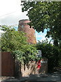
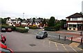
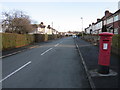
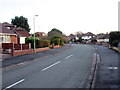
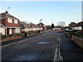
Living in CH2 2BZ places you within a compact residential cluster covering 6,281 square metres, situated in the Newton & Hoole Ward of Chester. This specific postcode area houses 1,012 residents and is defined by its proximity to two distinct historical districts that developed during the 19th and early 20th centuries. The settlement was first mentioned in 1119 in the Register of the Abbey of Saint Werburgh, with the area historically known as Home Hill or Newton Hollows due to a Roman roadway that created a distinctive hollow. Today, the character remains primarily suburban and residential, blending Victorian and interwar housing with heritage elements. Residents benefit from solid digital infrastructure and a low flood risk profile. The community feels established rather than transient, with a strong sense of history anchored by landmarks such as Newton Hollows, a designated Historic Monument and Public Footpath. Daily life revolves around the convenience of local shopping streets and public amenities, while the historical context of the Industrial Revolution provides an interesting backdrop to the neighbourhood. The area is not a commercial hub but a quiet residential zone where the pace is set by the needs of owner-occupiers rather than commuter traffic.
- Area Type
- Postcode
- Area Size
- 6281 m²
- Population
- 1012
- Population Density
- 4094 people/km²
Homes in CH2 2BZ are overwhelmingly owner-occupied, with 87% of properties held by their residents. This high percentage suggests a stable market where buyers establish themselves rather than short-term tenants leasing homes. The accommodation type is exclusively houses, meaning you will not find flats or purpose-built apartment blocks within this specific postcode. Instead, the housing stock consists of terraced, semi-detached, or detached properties typical of Victorian and interwar construction found in Chester's expanding suburbs. The area was historically part of Hoole Urban District until 1954, and Newton until 1936, explaining the established nature of the buildings. For buyers looking at this small cluster, the market is likely geared toward替换 or upgrading existing stock rather than new-build developments. The high ownership rate implies that many houses have been in the same families for decades, often carrying maintenance histories that reflect generations of care. There are no balcony flats or basement apartments common in modern urban districts. The scarcity of rental accommodation further reinforces the exclusive nature of this residential pocket.
House Prices in CH2 2BZ
Showing 9 properties
| Address | Type | Beds | Baths | Last Sale Price | Last Sale Date | |
|---|---|---|---|---|---|---|
| 1 Caldy Close, Chester, CH2 2BZ | Semi-detached | 3 | - | £195,250 | Apr 2015 | |
| 9 Caldy Close, Chester, CH2 2BZ | Semi-detached | - | - | £116,250 | Feb 2011 | |
| 4 Caldy Close, Chester, CH2 2BZ | Bungalow | - | - | £205,000 | Sep 2008 | |
| 2 Caldy Close, Chester, CH2 2BZ | Bungalow | - | - | £185,000 | Apr 2006 | |
| 3 Caldy Close, Chester, CH2 2BZ | Detached | - | - | £269,950 | Jun 2005 | |
| 7 Caldy Close, Chester, CH2 2BZ | Detached | - | - | £160,000 | Aug 2004 | |
| 6 Caldy Close, Chester, CH2 2BZ | Semi-detached | - | - | - | - | |
| 8 Caldy Close, Chester, CH2 2BZ | house | - | - | - | - | |
| 5 Caldy Close, Chester, CH2 2BZ | Bungalow | 3 | 2 | - | - |
Energy Efficiency in CH2 2BZ
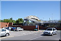
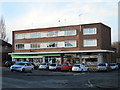
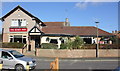
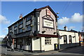
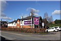
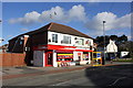
Daily life in CH2 2BZ is supported by a range of amenities clustered within practical reach. You have five retail options nearby, including Morrisons Upton, M&S Countess, and Morrisons Daily. These stores provide essential groceries and high-street shopping without requiring a long journey into Chester. There are also five railway stations accessible for commuting, with Bache, Chester, and Capenhurst being the most notable. For travelers and business visitors, Hawarden Airport is available for access. The lifestyle is rooted in the convenience of these five retail outlets and five rail connections rather than extensive leisure facilities. The area relies on local shopping streets rather than large supermarkets or department stores located within the postcode itself. While the residential character is strong, the immediate vicinity focuses on functional needs like food and transport links. The historic charm of Newton Hollows and the Ermine Public House, standing where a protective cross once stood, adds a cultural element to the surroundings. However, the data highlights shops and stations rather than cafes, cinemas, or parks within the immediate 6,281 square metres. Your routine involves easy access to home goods and travel hubs rather than major entertainment venues.
Amenities
Schools
Families considering CH2 2BZ have access to The Firs School, which is located within the vicinity of the postcode. This institution operates as an independent school, offering an alternative to the state sector for those seeking that specific educational model. While specific Ofsted ratings are not provided in the current data, the presence of an independent school indicates a choice for parents who prefer private education. The independent sector in Chester typically caters to families with higher disposable incomes, which aligns with the high home ownership rate of 87% in the area. Most children in CH2 2BZ will likely continue their education at local state schools located just outside the immediate 6,281 square metre boundary, as independent schools generally serve wider catchment areas. The mix of available education options gives residents flexibility. However, without a state school listed directly in the data for this specific cluster, parents must rely on the neighbourhood's larger boundaries to find comprehensive school places. The Firs School serves as the primary educational landmark associated with this location in the available records.
| Rank | School | Type | Entry gender | Ages |
|---|
Explore more schools in this area
Go to Schools tabDemographics
The community profile in CH2 2BZ reflects a mature, predominantly owner-occupied population. The median age stands at 47 years, with adults between 30 and 64 years representing the most common age range. This demographic skew indicates a neighbourhood settled by families and long-term residents rather than young professionals or students. Home ownership is exceptionally high at 87%, suggesting that the majority of households have purchased their properties and are settled into the area. Accommodation types are exclusively houses, aligning with the historical suburban development of Hoole and Newton. The predominant ethnic group is White, consistent with the broader character of this part of Cheshire. The population density reaches 161,128 people per square kilometre, a figure that results from measuring a very small geographic area of 6,281 square metres against the resident count. While the physical footprint is small, the concentration of people creates a compact environment. The absence of large young singles or student populations contributes to a stable, quiet atmosphere. Deprivation is not a factor highlighted in the available statistics, which focus primarily on age, ownership, and ethnic composition.
Household Size
Accommodation Type
Tenure
Ethnic Group
Religion
Household Composition
Age
Household Deprivation
NS-SEC
Explore more demographic insights in this area
Go to Demographics tabPlanning
Planning Constraints
- Flood RiskPremium
- Ramsar Wetland SitesPremium
- Area of Outstanding Natural BeautyPremium
- Protected Nature ReservePremium
- Protected WoodlandPremium