Area Overview for CH2 2AX
Photos of CH2 2AX
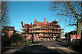
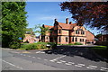
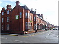
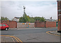
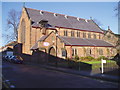
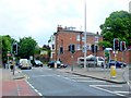
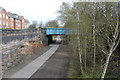
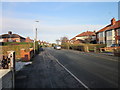
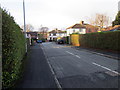
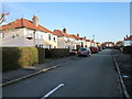
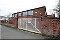
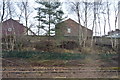
100 photos from this area
Area Information
Key information about the CH2 2AX including its size, population, and administrative classification.
- Area Type
- Postcode
- Area Size
- 1.9 hectares
- Population
- Not available
- Population Density
- Not available
House Prices in CH2 2AX
100
Properties
£1,096,757
Average Sold Price
£160,000
Lowest Price
£5,790,000
Highest Price
Showing 100 properties
| Address | Type | Beds | Baths | Last Sale Price | Last Sale Date | |
|---|---|---|---|---|---|---|
| Abbeygate, Victoria Road, Chester, CH2 2AX | Flat | - | - | £5,790,000 | Dec 2024 | |
| 47 Victoria Road, Chester, CH2 2AX | house | 3 | 1 | £294,000 | Sep 2024 | |
| 35 Victoria Road, Chester, CH2 2AX | Semi-detached | 5 | 2 | £412,300 | Oct 2017 | |
| 51 Victoria Road, Chester, CH2 2AX | Semi-detached | 4 | 4 | £399,950 | Mar 2017 | |
| 71 Victoria Road, Chester, CH2 2AX | Detached | 5 | - | £364,000 | Dec 2014 | |
| 67 Victoria Road, Chester, CH2 2AX | Semi-detached | 6 | 2 | £257,050 | May 2006 | |
| 45 Victoria Road, Chester, CH2 2AX | Terraced | 3 | 2 | £160,000 | Jan 2006 | |
| 35A Victoria Road, Chester, CH2 2AX | Flat | 1 | 1 | - | - | |
| Elysium, 53 Victoria Road, Chester, CH2 2AX | Detached | 1 | 1 | - | - | |
| Victoria House Care Home, 63 Victoria Road, Chester, CH2 2AX | Detached | 2 | 2 | - | - |
Page 1 of 10
Energy Efficiency in CH2 2AX
Amenities
Schools
| Rank | School | Type | Entry gender | Ages |
|---|
Explore more schools in this area
Go to Schools tabDemographics
Household Size
One person
most common
Accommodation Type
Flats
most common
Tenure
29
majority
Ethnic Group
White
most common
Religion
N/A
most common
Household Composition
N/A
most common
Age
22
median
Young Adults (15-29 years)
most common
Household Deprivation
N/A
with no deprivation
NS-SEC
16
in Lower managerial occupations
Explore more demographic insights in this area
Go to Demographics tabPlanning
Planning Constraints
- Flood RiskPremium
- Ramsar Wetland SitesPremium
- Area of Outstanding Natural BeautyPremium
- Protected Nature ReservePremium
- Protected WoodlandPremium