Area Overview for CH1 5ZL
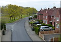
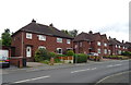
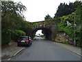
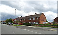
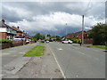
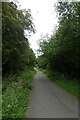
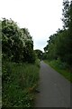
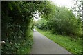
Photos of CH1 5ZL
Area Information
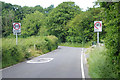
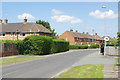
Living in CH1 5ZL means inhabiting a small, defined postcode area in Cheshire West and Chester, just one mile north-west of Chester city centre. This suburban district, known as Blacon Ward, sits on elevated ground near the Welsh border, offering views over the surrounding hills and the city. With a population of 1,217, it is a compact residential cluster shaped by post-war social housing built between 1948 and 1968 on former farmland. The area’s character is a mix of modest homes and open countryside, though it once carried a reputation for deprivation. Recent improvements have shifted this narrative, with infrastructure and services now supporting a stable community. Proximity to Chester’s cultural and commercial hubs, combined with nearby rail links, makes it a practical choice for commuters. The area’s history, including its medieval roots and the remnants of a 1930s golf course, adds layers to its identity. For buyers, CH1 5ZL offers a blend of affordability, accessibility, and a quiet suburban lifestyle, though its small size means the housing market is tightly focused.
- Area Type
- Postcode
- Area Size
- Not available
- Population
- 1217
- Population Density
- 3649 people/km²
The property market in CH1 5ZL is defined by a high rate of home ownership (69%) and a predominance of houses over flats. This suggests a community of long-term residents prioritising family-friendly housing, with limited rental activity. The area’s small size and post-war housing stock mean the available properties are likely modest in scale, with limited scope for redevelopment. Buyers should expect a tightly focused market, where properties are closely held and turnover is low. The presence of houses rather than apartments may appeal to those seeking space and privacy, though the area’s compact nature means proximity to amenities and transport is key. For investors, the market may offer stability but limited growth potential, with prices likely reflecting the area’s practical, suburban character rather than premium demand.
House Prices in CH1 5ZL
No properties found in this postcode.
Energy Efficiency in CH1 5ZL
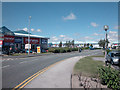
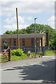
Daily life in CH1 5ZL is shaped by its proximity to essential amenities. Retail options include Spar stores and Heron Blacon, offering basic shopping needs within reach. The area’s rail network, with stations at Bache, Chester, and Capenhurst, provides seamless access to the city and beyond, while Hawarden Airport offers regional travel opportunities. Though the area is small, its integration with Chester means residents can access the city’s broader leisure and dining options. The surrounding countryside and historical sites, such as the former Blacon Hall, add a layer of local interest. The modest retail and transport infrastructure reflects a practical, no-frills lifestyle, ideal for those prioritising convenience over sprawling commercial hubs.
Amenities
Schools
Residents of CH1 5ZL have access to several primary schools within walking distance. Blacon Infant School, Highfield County Junior School, Highfield County Infant School, Highfield Community Primary School (rated ‘good’ by Ofsted), and The Arches Community Primary School (also ‘good’) provide a range of options for families. The concentration of primary schools suggests a focus on early education, with multiple institutions serving the area’s children. The presence of two schools with ‘good’ Ofsted ratings indicates a generally strong educational environment, though no secondary schools are listed. For families, this mix of schools offers flexibility, though reliance on primary education means secondary schooling would require travel to Chester or nearby towns. The proximity of these schools to homes underscores the area’s suitability for families prioritising convenience in education.
| Rank | School | Type | Entry gender | Ages |
|---|
Explore more schools in this area
Go to Schools tabDemographics
The community in CH1 5ZL is predominantly composed of adults aged 30–64, with a median age of 47. This suggests a mature, settled population, likely with strong family ties and long-term residency. Home ownership stands at 69%, indicating a stable housing market with a majority of residents living in their own homes. The area is characterised by houses rather than flats, reflecting a preference for single-family dwellings. The predominant ethnic group is White, though no specific diversity statistics are provided. The age profile and home ownership rates suggest a community focused on long-term living rather than transient rental stays. With no data on deprivation levels, the area’s quality of life appears tied to its infrastructure and services, such as nearby schools and transport links. The absence of younger demographics or higher rental occupancy implies a relatively conservative demographic structure.
Household Size
Accommodation Type
Tenure
Ethnic Group
Religion
Household Composition
Age
Household Deprivation
NS-SEC
Explore more demographic insights in this area
Go to Demographics tabPlanning
Planning Constraints
- Flood RiskPremium
- Ramsar Wetland SitesPremium
- Area of Outstanding Natural BeautyPremium
- Protected Nature ReservePremium
- Protected WoodlandPremium