Area Overview for CH1 1TD
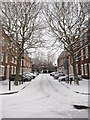
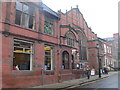
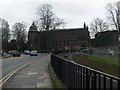
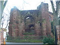
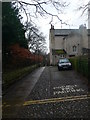
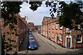
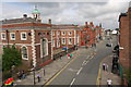
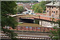
Photos of CH1 1TD


Area Information
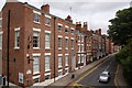
Living in CH1 1TD places you in a compact residential cluster within Chester, a historic city in Cheshire. With a population of 1,214, this postcode area is part of the Garden Quarter, a densely populated district near the University of Chester and the parish of St Oswald. The area’s character is shaped by its proximity to educational institutions, historic churches, and the broader city infrastructure. Daily life here is influenced by its small-scale nature, with residents likely to interact closely with local amenities and community spaces. The postcode’s location near the University of Chester suggests a mix of student and long-term residents, though the median age of 47 indicates a predominantly adult population. The area’s historical roots, including the Church of St Thomas of Canterbury (built 1872), add cultural depth to its modern-day appeal. While it lacks large-scale natural features, its integration with Chester’s rail network and retail hubs like Tesco Chester provides practical convenience for residents.
- Area Type
- Postcode
- Area Size
- Not available
- Population
- Not available
- Population Density
- Not available
The property market in CH1 1TD is characterised by a 46% home ownership rate, indicating that nearly half of properties are rented. The accommodation type is predominantly flats, which aligns with the area’s small-scale residential nature. This suggests a limited housing stock, likely concentrated in purpose-built or converted units. Given the low population density and small postcode area, the market is unlikely to offer a wide range of property types. Buyers should consider that the area’s proximity to Chester’s rail network and retail hubs may offset its compact size. However, the predominance of flats may appeal to those seeking low-maintenance living or rental opportunities. For those prioritising larger homes or land, the immediate surroundings may offer more options, but the data does not specify these.
House Prices in CH1 1TD
No properties found in this postcode.
Energy Efficiency in CH1 1TD
Residents of CH1 1TD benefit from nearby retail hubs, including Tesco Chester and M&S Chester, which provide everyday shopping needs. The area’s rail stations—Chester, Bache, and Capenhurst—offer easy access to the city centre and surrounding regions, while Hawarden Airport provides regional flight connections. Though the data does not mention parks or leisure facilities, the proximity to the Garden Quarter and historic sites like the Church of St Thomas of Canterbury suggests cultural and recreational opportunities. The compact nature of the area means amenities are within practical reach, fostering a convenient lifestyle. The presence of independent schools and the University of Chester adds to the area’s intellectual and social vibrancy. However, the absence of detailed information on parks or dining options means further research may be needed for those prioritising outdoor spaces or gastronomic choices.
Amenities
Schools
Residents of CH1 1TD have access to two independent schools: The Queen’s School and Robert Raikes Tutorial School. Both are private institutions, which may appeal to families seeking alternative educational pathways. The presence of independent schools suggests a community that values choice in education, though no Ofsted ratings are provided. These schools are likely to cater to older children, given the area’s adult demographic. However, the absence of state schools in the data means families with younger children may need to look further afield for primary or secondary education. The mix of independent schools could indicate a focus on private education, but the specific needs of local families are not detailed.
| Rank | School | Type | Entry gender | Ages |
|---|
Explore more schools in this area
Go to Schools tabDemographics
The community in CH1 1TD is predominantly composed of adults aged 30–64, with a median age of 47. Home ownership here stands at 46%, suggesting a mix of owner-occupied properties and rental units. The accommodation type is primarily flats, reflecting the area’s compact residential layout. The predominant ethnic group is White, though specific diversity metrics are not detailed in the data. The age profile indicates a mature population, which may influence local services and amenities. With no specific deprivation data provided, the area’s quality of life is likely shaped by its proximity to transport links and retail options. The absence of young families or students in the demographic breakdown might mean fewer childcare facilities or schools catering to younger age groups, though nearby independent schools exist.
Household Size
Accommodation Type
Tenure
Ethnic Group
Religion
Household Composition
Age
Household Deprivation
NS-SEC
Explore more demographic insights in this area
Go to Demographics tabPlanning
Planning Constraints
- Flood RiskPremium
- Ramsar Wetland SitesPremium
- Area of Outstanding Natural BeautyPremium
- Protected Nature ReservePremium
- Protected WoodlandPremium