Area Overview for Catterlen
Photos of Catterlen
Area Information
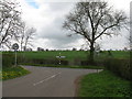
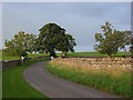
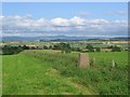
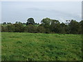
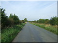
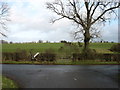
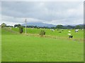
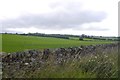
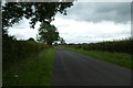
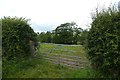
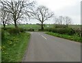
Living in Catterlen means settling into a small village and civil parish located three miles north-west of Penrith in Cumbria. The area encompasses 10.4 km² and follows a linear character along the B5305 road, which divides the settlement into two sections. Historically significant, Catterlen was once a township within Newton-Reigny parish before administrative changes in 1866. Today, the parish borders the more populous village of Newton Reigny, which was formerly administratively separate. Junction 41 of the M6 motorway sits at Catterlen, offering major road access and linking the village to wider travel networks. You will find historic landmarks here, including Catterlen Hall, a large house and former pele tower. Catterlen Old Hall in the neighbouring Newton Reigny holds scheduled monument status. The parish contains seven listed buildings recorded in the National Heritage List. Newton Rigg College, associated with the Yorkshire-based Askham Bryan College, is also located within the parish boundaries. This setting gives daily life a quiet, rural pace defined by heritage and proximity to key transport links.
- Area Type
- Parish
- Area Size
- 10.4 km²
- Population
- Not available
- Population Density
- Not available
Demographics
The community in Catterlen reflects an older demographic profile, with a median age of 70. You will find that the population leans heavily towards senior residents rather than families with young children. This age distribution shapes the local rhythm, creating a demographic where older generations reside in high numbers. Home ownership is a defining feature of this area, with 74% of residents owning their properties outright. The high rate of ownership suggests stability and long-term residency within the civil parish. You are unlikely to encounter transient populations here, as most residents have established roots. The parish includes the village of Newton Reigny, which contributes to the total population figures, although specific breakdowns for each component are not separately detailed in the available data. The linear layout of the village along the main road influences household clustering. There is no specific data provided regarding household composition types, predominant ethnic groups, or religious affiliations within the parish. You will find a homogenous community driven by age and occupancy status. The total population fluctuated between the 2001 and 2011 censuses, rising from 471 to 605. This modest population size reinforces the intimate, village-based nature of living in Catterlen, where neighbours are likely to know one another personally.
Household Size
Accommodation Type
Tenure
Ethnic Group
Religion
Household Composition
Age
Household Deprivation
NS-SEC
Explore more demographic insights in this area
Go to Demographics tabPlanning
Planning Constraints
- Flood RiskPremium
- Ramsar Wetland SitesPremium
- Area of Outstanding Natural BeautyPremium
- Protected Nature ReservePremium
- Protected WoodlandPremium
- Crime RiskPremium