Area Overview for Carnforth & Millhead Ward
Photos of Carnforth & Millhead Ward
Area Information
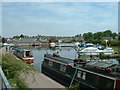
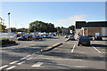
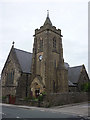
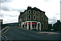
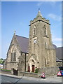
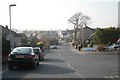
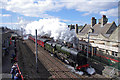
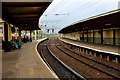
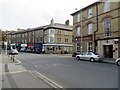
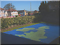
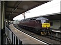
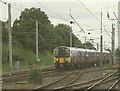
Carnforth & Millhead Ward stands as a distinct residential community within the City of Lancaster district, covering an area of 6.7 square kilometres. You are looking at a location situated approximately seven miles north of Lancaster, marking the north-east end of Morecambe Bay. The River Keer defines the boundary with Warton to the north-north-west, while key infrastructure including the West Coast Main Line, the A6 road, and the Lancaster Canal cut directly through the town. This mix of natural waterways and major thoroughfares has shaped a long history, with the name itself likely originating from an Anglo-Saxon ford for cranes. Daily life here balances industrial heritage with rural tranquillity. The ward encompasses the town centre and the Millhead area, offering a variety of settings for residents. Although specific population figures and current median age statistics are not provided in this summary, the area attracts those who value its strategic position between Lancaster and Carlisle. The physical environment is characterised by the presence of protected natural areas, including designated sites of international importance for wildlife. Living in Carnforth & Millhead Ward means existing within a boundary that respects significant ecological value, ensuring that new developments face scrutiny against these protected status. It is a place where the past remains visible in the street names and the landscape, even as modern transport links keep it connected to the wider region.
- Area Type
- District Borough Unitary Ward
- Area Size
- 6.7 km²
- Population
- Not available
- Population Density
- Not available
Demographics
The community profile of Carnforth & Millhead Ward reveals a settlement with a mature population. Data indicates a median age of 70 years, suggesting a demographic skewed significantly towards older adults compared to the national average. This age distribution likely influences local services and neighbourhood dynamics, creating an environment where quieter streets and established social networks are common. Regarding housing stability, 76% of residents live in owner-occupied homes. This high ownership rate points to a stable, long-term resident base rather than a transient rental market. The ward profile does not provide specific breakdowns for age ranges within the total population or detailed household composition types beyond the aggregate data. Similarly, there is no data available regarding the predominant ethnic groups or religious affiliations for this specific ward. Consequently, any detailed analysis of cultural diversity or coding within the settlement relies on the broader available metrics. The closure of specific workforce industries in the area can inform why the population appears older, as younger generations often migrate to hubs like Lancaster for employment. When assessing Carnforth & Millhead Ward for family life, one must consider that the housing stock and age profile cater primarily to retirement or established households. The lack of specific minority data suggests a demographic homogeneity that aligns with many traditional northern English towns. Buyers interested in this area are purchasing into a community defined by senior residency and high home ownership rates.
Household Size
Accommodation Type
Tenure
Ethnic Group
Religion
Household Composition
Age
Household Deprivation
NS-SEC
Explore more demographic insights in this area
Go to Demographics tabPlanning
Planning Constraints
- Flood RiskPremium
- Ramsar Wetland SitesPremium
- Area of Outstanding Natural BeautyPremium
- Protected Nature ReservePremium
- Protected WoodlandPremium
- Crime RiskPremium