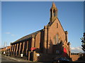
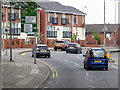
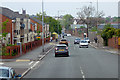
Area Overview for Canning Ward
Photos of Canning Ward


Area Information
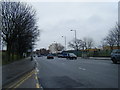
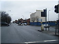
Canning Ward is a compact district within the City of London, covering just 1.1 square kilometres. Despite its small footprint, it accommodates a population of 1,317 residents, resulting in a density of 1,192 people per square kilometre. Living in Canning Ward means navigating a highly concentrated urban environment typical of the financial district. You will find a neighbourhood defined by its proximity to major economic hubs rather than suburban sprawl or rural green belts. The area is entirely within England, forming a specific administrative ward that serves a distinct demographic profile. Daily life here revolves around the city centre core, with residents accustomed to the rapid pace of London's financial quarter. The small size of the ward suggests a tight-knit yet anonymous urban existence where services and transport links are immediate. Prospective buyers should recognise that the character of Canning Ward is inextricably linked to its function as a central city borough unitary ward. You are purchasing a home in one of the smallest residential zones in the capital, where every plot of land is valuable.
- Area Type
- District Borough Unitary Ward
- Area Size
- 1.1 km²
- Population
- 1317
- Population Density
- 1192 people/km²
Demographics
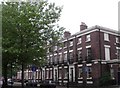
The community in Canning Ward is exceptionally older compared to the rest of the United Kingdom. The median age for residents is 70 years, indicating a population dominated by senior citizens. This statistic defines the social fabric of the area, suggesting a neighbourhood where long-term residents and retirees form the majority. Home ownership stands at only 16%, a figure that highlights a reliance on renting rather than owning. With such a low rate of ownership, most individuals living in Canning Ward are tenants rather than landlords. The demographic data shows no breakdown by specific age ranges beyond the total or predominant ethnicity, implying a homogenous age profile. The lack of data on household composition details means the prevailing picture is one of an older, predominantly rental-dependent community. This profile differs sharply from younger family-oriented areas of London. The low ownership rate often correlates with high property values and limited space for larger families. For anyone considering homes in Canning Ward, understanding that the street corners are likely populated by the elderly is essential.
Household Size
Accommodation Type
Tenure
Ethnic Group
Religion
Household Composition
Age
Household Deprivation
NS-SEC
Explore more demographic insights in this area
Go to Demographics tabPlanning
Planning Constraints
- Flood RiskPremium
- Ramsar Wetland SitesPremium
- Area of Outstanding Natural BeautyPremium
- Protected Nature ReservePremium
- Protected WoodlandPremium
- Crime RiskPremium