Area Overview for CA9 3SL
Photos of CA9 3SL
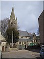
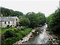
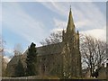
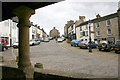
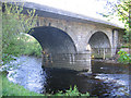
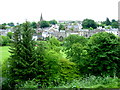
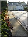
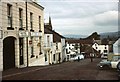
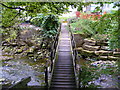
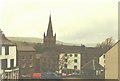
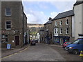
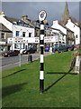
100 photos from this area
Area Information
Key information about the CA9 3SL including its size, population, and administrative classification.
- Area Type
- Postcode
- Area Size
- 1.2 hectares
- Population
- 2026
- Population Density
- 14 people/km²
House Prices in CA9 3SL
21
Properties
£108,061
Average Sold Price
£11,050
Lowest Price
£425,000
Highest Price
Showing 21 properties
| Address | Type | Beds | Baths | Last Sale Price | Last Sale Date | |
|---|---|---|---|---|---|---|
| Alstonia, Townhead, Alston, CA9 3SL | Terraced | 3 | 2 | £30,000 | Mar 2025 | |
| Rainbow House, Townhead, Alston, CA9 3SL | Terraced | 3 | 1 | £120,000 | Dec 2021 | |
| Albert House, Townhead, Alston, CA9 3SL | house | - | - | £425,000 | Jun 2021 | |
| Grange House, Townhead, Alston, CA9 3SL | Semi-detached | 5 | 1 | £150,000 | Nov 2020 | |
| Henley Mount, Townhead, Alston, CA9 3SL | Detached | - | - | £11,050 | Jun 2020 | |
| Vale View, Townhead, Alston, CA9 3SL | Terraced | 3 | 1 | £100,000 | Jan 2008 | |
| Amble Cottage, Townhead, Alston, CA9 3SL | Bungalow | - | - | £25,000 | Sep 2004 | |
| Aldenston Barn, Townhead, Alston, CA9 3SL | house | 1 | 1 | £45,500 | Nov 2001 | |
| Steel House, Townhead, Alston, CA9 3SL | house | - | - | £66,000 | Apr 1998 | |
| Wheelflatt, Westoe House, Townhead, Alston, CA9 3SL | Flat | 2 | 1 | - | - |
Page 1 of 3
Energy Efficiency in CA9 3SL
Amenities
Schools
| Rank | School | Type | Entry gender | Ages |
|---|
Explore more schools in this area
Go to Schools tabDemographics
Household Size
Two person
most common
Accommodation Type
Houses
most common
Tenure
71
majority
Ethnic Group
White
most common
Religion
N/A
most common
Household Composition
N/A
most common
Age
47
median
Adults (30-64 years)
most common
Household Deprivation
N/A
with no deprivation
NS-SEC
29
in Lower managerial occupations
Explore more demographic insights in this area
Go to Demographics tabPlanning
Planning Constraints
- Flood RiskPremium
- Ramsar Wetland SitesPremium
- Area of Outstanding Natural BeautyPremium
- Protected Nature ReservePremium
- Protected WoodlandPremium