Area Overview for CA8 9JJ
Photos of CA8 9JJ
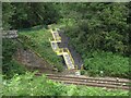
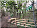
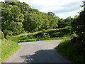
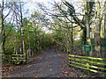
18 photos from this area
Area Information
Key information about the CA8 9JJ including its size, population, and administrative classification.
- Area Type
- Postcode
- Area Size
- 20.6 hectares
- Population
- 1965
- Population Density
- 91 people/km²
House Prices in CA8 9JJ
6
Properties
£325,000
Average Sold Price
£300,000
Lowest Price
£350,000
Highest Price
Showing 6 properties
| Address | Type | Beds | Baths | Last Sale Price | Last Sale Date | |
|---|---|---|---|---|---|---|
| Tow Top, How Street, How Mill, CA8 9JJ | house | - | - | £300,000 | Jul 2019 | |
| Middle Gelt House, How Street, How Mill, CA8 9JJ | Detached | 4 | 1 | £350,000 | Oct 2018 | |
| Middle Gelt Bridge, Hallbankgate On The A 689 To The C 1024, Talkin, CA8 9JJ | commercial | - | - | - | - | |
| Caravan, Tow Top, How Street, How Mill, CA8 9JJ | Mobile Home | - | - | - | - | |
| Gas Valve Compound Adjacent To River Gelt, Road Leading From Middle Gelt Viaduct To Junction At Ring Gate Lodge, Castle Carrock, CA8 9JJ | commercial | - | - | - | - | |
| Coach House At Middle Gelt House, How Street, How Mill, CA8 9JJ | Detached | - | - | - | - |
Energy Efficiency in CA8 9JJ
Amenities
Schools
| Rank | School | Type | Entry gender | Ages |
|---|
Explore more schools in this area
Go to Schools tabDemographics
Household Size
Two person
most common
Accommodation Type
Houses
most common
Tenure
84
majority
Ethnic Group
White
most common
Religion
N/A
most common
Household Composition
N/A
most common
Age
47
median
Adults (30-64 years)
most common
Household Deprivation
N/A
with no deprivation
NS-SEC
34
in Lower managerial occupations
Explore more demographic insights in this area
Go to Demographics tabPlanning
Planning Constraints
- Flood RiskPremium
- Ramsar Wetland SitesPremium
- Area of Outstanding Natural BeautyPremium
- Protected Nature ReservePremium
- Protected WoodlandPremium