Area Overview for CA7 8EU
Photos of CA7 8EU
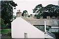
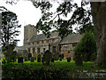
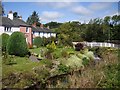
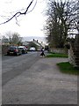
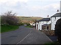
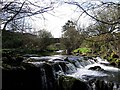
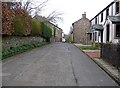
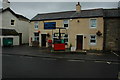

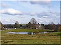

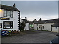
100 photos from this area
Area Information
Key information about the CA7 8EU including its size, population, and administrative classification.
- Area Type
- Postcode
- Area Size
- 47.0 hectares
- Population
- 1867
- Population Density
- 14 people/km²
House Prices in CA7 8EU
39
Properties
£310,200
Average Sold Price
£106,000
Lowest Price
£600,000
Highest Price
Showing 39 properties
| Address | Type | Beds | Baths | Last Sale Price | Last Sale Date | |
|---|---|---|---|---|---|---|
| Town Head House, Minor Road From Upton Towards Hesket Newmarket, Upton, Caldbeck, CA7 8EU | house | - | - | £600,000 | Nov 2020 | |
| Mardale Gate, Minor Road From Upton Towards Hesket Newmarket, Upton, Caldbeck, CA7 8EU | Terraced | - | - | £200,000 | Nov 2015 | |
| Bridge House, Minor Road From B 5299 To The Street, Upton, Caldbeck, CA7 8EU | house | - | - | £450,000 | Dec 2013 | |
| Upton Villa, Minor Road From B 5299 To The Street, Upton, Caldbeck, CA7 8EU | Semi-detached | 2 | 1 | £195,000 | Feb 2006 | |
| Brook House, Minor Road From B 5299 To The Street, Upton, Caldbeck, CA7 8EU | house | - | - | £106,000 | Jun 1999 | |
| Fouracres, Access Road To Fell View, Upton, Caldbeck, CA7 8EU | Detached | 3 | 1 | - | - | |
| Becksteps, Minor Road From B 5299 To The Street, Upton, Caldbeck, CA7 8EU | Semi-detached | 3 | 2 | - | - | |
| 5, Upton Cottages, Minor Road From B 5299 To The Street, Upton, Caldbeck, CA7 8EU | Terraced | 3 | - | - | - | |
| 4, Upton Cottages, Minor Road From B 5299 To The Street, Upton, Caldbeck, CA7 8EU | Cottage | 3 | 1 | - | - | |
| Wedgewood, Access Road To Fell View, Upton, Caldbeck, CA7 8EU | Cottage | 2 | - | - | - |
Page 1 of 4
Energy Efficiency in CA7 8EU
Amenities
Schools
| Rank | School | Type | Entry gender | Ages |
|---|
Explore more schools in this area
Go to Schools tabDemographics
Household Size
Two person
most common
Accommodation Type
Houses
most common
Tenure
79
majority
Ethnic Group
White
most common
Religion
N/A
most common
Household Composition
N/A
most common
Age
47
median
Adults (30-64 years)
most common
Household Deprivation
N/A
with no deprivation
NS-SEC
37
in Lower managerial occupations
Explore more demographic insights in this area
Go to Demographics tabPlanning
Planning Constraints
- Flood RiskPremium
- Ramsar Wetland SitesPremium
- Area of Outstanding Natural BeautyPremium
- Protected Nature ReservePremium
- Protected WoodlandPremium